അടവി
ദൃശ്യരൂപം
| അടവി | |
|---|---|
 | |
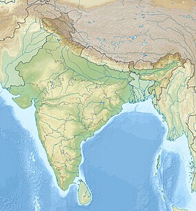
| Location | Konni taluk, Pathanamthitta, Kerala, India |
| Nearest city | Thannithode |
| Coordinates | 9°15′52″N 76°56′08″E / 9.2644°N 76.9355°E |
| Governing body | Kerala Tourism Development Corporation Department of Forests and Wildlife, Kerala |
| pathanamthittatourism | |
പത്തനംതിട്ട ജില്ലയിലെ കൊന്നിയിൽ സ്ഥിതിചെയ്യുന്ന ഒരു പ്രധാന വിനോദസഞ്ചാര കേന്ദ്രമാണ് അടവി. കല്ലാർ നദിയുടെ തീരത്തായാണ് ഇത് സ്ഥിതിചെയ്യുന്നത്.[1] കേരള ടൂറിസം ഡെവലപ്മെന്റ് കോർപ്പറേഷനും വനം, വന്യജീവി വകുപ്പും സംയുക്തമായാണ് അടവിയിലെ ഇക്കോ ടൂറിസം പദ്ധതി ആരംഭിച്ചത്.[2]
ആകർഷണം
[തിരുത്തുക]അടവിയിലെ പ്രധാന ആകർഷണം കുട്ടവഞ്ചി സവാരി, കല്ലാർ നദിയുടെ തീരത്ത് മരത്തിന് മുകളിൽ സ്ഥാപിച്ചിരിക്കുന്ന ബാംബൂ ഹട്ട് എന്നിവയാണ്.[3][4][5][6]
ചിത്രശാല
[തിരുത്തുക]-
പെരുവാലി ബാംബൂ ഹട്ട്
-
പെരുവാലി ബാംബൂ ഹട്ട് ദൂരക്കാഴ്ച
-
കുട്ടവഞ്ചി
-
കുട്ടവഞ്ചികൾ കരയിൽ കയറ്റിവച്ച നിലയിൽ
അവലംബം
[തിരുത്തുക]- ↑ "Ecotourism blooms in Konni". The Hindu. Retrieved 18 September 2017.
- ↑ "Spotlight on Adavi and Gavi". The Hindu. Retrieved 18 September 2017.
- ↑ "Bamboo huts ready at Adavi". The Hindu. Retrieved 18 September 2017.
- ↑ "Treetop cottages at Adavi". The Hindu. Retrieved 18 September 2017.
- ↑ "Here, tourism blooms in trees and banks on a river". The New Indian Express. Retrieved 18 September 2017.
- ↑ വിജിത് ഉഴമലയ്ക്കൽ എഴുതിയ ഫേസ്ബുക്ക് പോസ്റ്റ് " 2019 സെപ്റ്റംബർ 25 ന് ശേഖരിച്ചത്


