"ദക്ഷിണ കലിമന്താൻ" എന്ന താളിന്റെ പതിപ്പുകൾ തമ്മിലുള്ള വ്യത്യാസം
No edit summary |
(ചെ.) വർഗ്ഗം:ഇന്തോനേഷ്യയിലെ പ്രവിശ്യകൾ ചേർത്തു ഹോട്ട്ക്യാറ്റ് ഉപയോഗിച്ച് |
||
| വരി 168: | വരി 168: | ||
{{South Kalimantan}} |
{{South Kalimantan}} |
||
{{Provinces of Indonesia}} |
{{Provinces of Indonesia}} |
||
[[വർഗ്ഗം:ഇന്തോനേഷ്യയിലെ പ്രവിശ്യകൾ]] |
|||
02:08, 15 നവംബർ 2018-നു നിലവിലുണ്ടായിരുന്ന രൂപം
South Kalimantan Kalimantan Selatan | ||||||||
|---|---|---|---|---|---|---|---|---|
| Other transcription(s) | ||||||||
| • Jawi | کاليمانتان سلاتن | |||||||
| • Banjarese | Kalimantan Salatan | |||||||
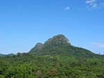
From top, left to right : Pulau Kembang, Floating market in Banjarmasin, Loksado Hill, Martapura River, Proclamation Monument, Tanjung Dewa, Mount Halau-Halau | ||||||||
| ||||||||
| Motto(s): Haram Manyarah Waja Sampai Kaputing (Banjarese) (Never Surrender, Strong As Steel Until The End) | ||||||||
 Location of South Kalimantan in Indonesia | ||||||||
| Coordinates: 2°30′S 115°30′E / 2.500°S 115.500°E | ||||||||
| Country | ||||||||
| Established | August 14, 1950 | |||||||
| Capital | ||||||||
| • ഭരണസമിതി | South Kalimantan Regional Government | |||||||
| • Governor | H. Sahbirin Noor | |||||||
| • Vice Governor | Rudy Resnawan | |||||||
| • ആകെ | 38,744.23 ച.കി.മീ.(14,959.23 ച മൈ) | |||||||
| •റാങ്ക് | 19th | |||||||
| ഉയരത്തിലുള്ള സ്ഥലം | 1,901 മീ(6,237 അടി) | |||||||
(2014)[1] | ||||||||
| • ആകെ | 39,13,908 | |||||||
| • റാങ്ക് | 17th | |||||||
| • ജനസാന്ദ്രത | 100/ച.കി.മീ.(260/ച മൈ) | |||||||
| • Ethnic groups | Banjarese (76%), Javanese (13%)[2] | |||||||
| • Languages | Indonesian (official), Banjarese | |||||||
| സമയമേഖല | UTC+8 (Indonesia Central Time) | |||||||
| Postcodes | 70xxx, 71xxx, 72xxx | |||||||
| Area codes | (62)5xx | |||||||
| ISO കോഡ് | ID-KS | |||||||
| Vehicle sign | DA | |||||||
| HDI | ||||||||
| HDI rank | 21st (2014) | |||||||
| Largest city by area | Banjarbaru - 371.00 square kilometres (143.24 sq mi) | |||||||
| Largest city by population | Banjarmasin - (625,481 - 2010) | |||||||
| Largest regency by area | Kotabaru Regency - 9,482.73 square kilometres (3,661.30 sq mi) | |||||||
| Largest regency by population | Banjar Regency - (506,839 - 2010) | |||||||
| വെബ്സൈറ്റ് | Government official site | |||||||
| = | ||||||||

ദക്ഷിണ കാലിമന്തൻ (ഇന്തോനേഷ്യൻ: Kalimantan Selatan) ഇന്തോനേഷ്യയിലെ ഒരു പ്രവിശ്യയാണ്. ഇന്തോനേഷ്യൻ പ്രദേശമായ ബോർണിയോയിലെ കാലിമന്തനിൽ ഇത് സ്ഥിതിചെയ്യുന്നു, പ്രവിശ്യാ തലസ്ഥാനം ബഞ്ചാർമാസിൻ ആണ്. ദക്ഷിണ കലിമാണ്ടൻ ജനതയുടെ 2010-ലെ സെൻസസിൽ 3.625 ദശലക്ഷം ജനസംഖ്യ രേഖപ്പെടുത്തപ്പെട്ടിരുന്നു.[1]ഏറ്റവും പുതിയ ഔദ്യോഗിക കണക്ക് (ജനുവരി 2014-ൽ) 3,913,908 ആണ് .കാലിമന്തനിൽ അഞ്ച് ഇന്തോനേഷ്യൻ പ്രവിശ്യകളിൽ ഒന്ന്, കിഴക്ക് മക്കസാർ കടലിടുക്ക്, പടിഞ്ഞാറ്, വടക്ക് മധ്യ കാലിമന്തൻ, തെക്ക് ജാവ കടൽ, വടക്ക് കിഴക്ക് കാലിമന്തൻ എന്നിവയാണ് അതിർത്തികൾ.
ഭൂമിശാസ്ത്രം
ബൻജർമ്മസിൻ നഗരവുമായി ബന്ധിപ്പിക്കുന്ന ദക്ഷിണ കാലിമന്തൻ പ്രവിശ്യയിൽ 11 റിജൻസികളും 2 നഗരങ്ങളും ഭൂമിശാസ്ത്രപരമായി 114 ° 19 '13' '- 116 ° 33' 28 കിഴക്കൻ രേഖാംശവും 1 ° 21 '49' '- 4 ° 10' 14 തെക്ക് രേഖാംശം. എന്നിവയ്ക്കിടയിൽ സ്ഥിതിചെയ്യുന്നു. കലിമന്തൻ ദ്വീപിന്റെ മൊത്തം വിസ്തീർണ്ണം ദക്ഷിണ കലിമന്തൻ പ്രദേശത്തിന്റെ 6.98 ശതമാനമാണ്. ഇത് 37.530,52 ചതുരശ്ര കിലോമീറ്ററാണ്.
- മധ്യ കാലിമന്തൻ പ്രവിശ്യ പടിഞ്ഞാറ്
- കിഴക്ക് മക്കസാർ കടലിടുക്ക്
- തെക്ക് ജാവാ കടൽ
- വടക്ക് കിഴക്ക് കാലിമന്തൻ പ്രവിശ്യ
ഭൂപ്രകൃതിയുടെ അടിസ്ഥാനത്തിൽ ദക്ഷിണ കാലിമന്തൻ പ്രവിശ്യയിൽ 4 ഭാഗങ്ങൾ, ഭൂവിസ്തൃതി, ചതുപ്പുകൾ, കുന്നുകൾ, മലകൾ എന്നിവ ഉൾപ്പെടുന്നു. ഭൂമിയുടെ ചെരുവ് 4 ക്ലാസ് വർഗ്ഗീകരണം ആയി കാണിച്ചിരിക്കുന്നു. ദക്ഷിണ കലിമന്തൻ പ്രവിശ്യയുടെ ഭൂമി ചെരുവ് 43.31% 0-2% ആണ്. വിസ്തൃതമായ ഭൂമിയുടെ ചെരുവിൻറെ വിശദാംശങ്ങൾ ചുവടെ ചേർക്കുന്നു.
- 0 - 2% : 1.625.384 Ha (43,31%)
- > 2–15 %: 1.182.346 Ha (31,50%)
- 15–40 %: 714.127 Ha (19,02%)
- > 40% : 231.195 Ha (6,16%)
ദക്ഷിണ കാലിമന്തൻ പ്രവിശ്യയുടെ വിസ്തീർണ്ണം സമുദ്രനിരപ്പിൽ നിന്നുള്ള ഉയരം 6 ക്ലാസ് ആയി വിഭജിക്കപ്പെട്ടിരിക്കുന്നു. ദക്ഷിണ കാലിമന്തൻ പ്രദേശത്തിന്റെ ഭൂരിഭാഗവും സമുദ്രനിരപ്പിൽ നിന്ന് 25-100 മീറ്റർ ഉയരത്തിലാണ്, അതായത് 31.09%.
ദക്ഷിണ കാലിമന്തൻ പ്രവിശ്യ പ്രദേശത്തുകൂടി ബാരിറ്റോ, റിയാം കാനൻ, റിയാം കിവ, ബലാൻഗൻ, ബടാങ് അലൈ, അമാണ്ടിറ്റ്, ടപിൻ, കിന്റാപ്, ബറ്റൂലിസിൻ, സമ്പനഹാൻ, തുടങ്ങിയ പല നദികളും ഒഴുകുന്നുണ്ട്. ഈ നദികൾ മെറേറ്റസ് പർവതത്തിൽ നിന്നും ജാവ കടൽ, മക്കസാർ കടലിടുക്ക് വരെ ഒഴുകുന്നു..
അഡ്മിനിസ്ട്രേറ്റീവ് ഡിവിഷനുകൾ
2010 ലെ സെൻസസ് അനുസരിച്ച് തെക്കൻ കലിമാന്റനിലെ രണ്ട് പട്ടണങ്ങൾ (കബൂപ്പട്ടൺ), രണ്ട് നഗരങ്ങൾ (കോട്ട), തങ്ങളുടെ പ്രദേശങ്ങളും അവരുടെ ജനസംഖ്യയും ചേർന്ന് 2010 ലെ ജനസംഖ്യാ കണക്കുകളുമുണ്ട്. ഏറ്റവും പുതിയ ഔദ്യോഗിക കണക്ക് പ്രകാരം (2014 ജനുവരിയോടെ):[3] അവരുടെ ഭരണ തലസ്ഥാനങ്ങളോടൊപ്പം
| Name | Area in Sq. km. |
Population 2010 Census |
Population 2014 estimate |
Capital | HDI[4] 2014 Estimates |
|---|---|---|---|---|---|
| Banjarbaru City | 371.00 | 1,99,627 | 2,15,440 | Banjarbaru | 0.773 (High) |
| Banjarmasin City | 72.00 | 6,25,481 | 6,75,030 | Banjarmasin | 0.749 (High) |
| Balangan Regency | 1,878.30 | 1,12,430 | 1,21,336 | Paringin | 0.644 (Medium) |
| Banjar Regency | 4,668.00 | 5,06,839 | 5,46,990 | Martapura | 0.657 (Medium) |
| Barito Kuala Regency | 2,996.46 | 2,76,147 | 2,98,023 | Marabahan | 0.625 (Medium) |
| Central Hulu Sungai Regency (Hulu Sungai Tengah) |
1,472.00 | 2,43,460 | 2,62,746 | Barabai | 0.653 (Medium) |
| Kotabaru Regency | 9,482.73 | 2,90,142 | 3,13,126 | Kotabaru | 0.657 (Medium) |
| North Hulu Sungai Regency (Hulu Sungai Utara) |
892.70 | 2,09,246 | 2,25,822 | Amuntai | 0.613 (Medium) |
| South Hulu Sungai Regency (Hulu Sungai Selatan) |
1,804.94 | 2,12,485 | 2,29,318 | Kandangan | 0.652 (Medium) |
| Tabalong Regency | 3,766.97 | 2,18,620 | 2,35,939 | Tanjung | 0.683 (Medium) |
| Tanah Bumbu Regency | 5,006.96 | 2,67,929 | 2,89,154 | Batulicin | 0.669 (Medium) |
| Tanah Laut Regency | 3,631.35 | 2,96,333 | 3,19,808 | Pelaihari | 0.665 (Medium) |
| Tapin Regency | 2,700.82 | 1,67,877 | 1,81,176 | Rantau | 0.669 (Medium) |
| Total | 38,744.23 | 36,26,616 | 39,13,908 | Banjarmasin | 0.676 (Medium) |
അവലംബം
![]() വിക്കിവൊയേജിൽ നിന്നുള്ള ദക്ഷിണ കലിമന്താൻ യാത്രാ സഹായി
വിക്കിവൊയേജിൽ നിന്നുള്ള ദക്ഷിണ കലിമന്താൻ യാത്രാ സഹായി
- ↑ 1.0 1.1 Central Bureau of Statistics: Census 2010 Archived 2010-11-13 at the Wayback Machine., retrieved 17 January 2011 (Indonesian ഭാഷയിൽ)
- ↑ "INDONESIA: Population and Administrative Divisions" (PDF). The Permanent Committee on Geographical Names. 2003.
- ↑ Biro Pusat Statistik, Jakarta, 2014.
- ↑ Indeks-Pembangunan-Manusia-2014


