ഇൻയോ കൗണ്ടി
County of Inyo | ||
|---|---|---|
 Wildflowers blooming in Death Valley after an unusually wet winter | ||
| ||
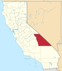
 Location in the state of California | ||
 California's location in the United States | ||
| Coordinates: 36°35′N 117°25′W / 36.583°N 117.417°W | ||
| Country | ||
| State | ||
| Region | Eastern California | |
| Established | March 22, 1866[1] | |
| നാമഹേതു | "dwelling place of the great spirit" in Mono language | |
| County seat | Independence | |
| Largest city | Bishop | |
| • Board of Supervisors | Supervisors[2]
| |
| • Assemblymember | Devon Mathis (R) | |
| • State senator | Tom Berryhill (R)[3] | |
| • U. S. rep. | Paul Cook (R) | |
| • ആകെ | 10,227 ച മൈ (26,490 ച.കി.മീ.) | |
| • ഭൂമി | 10,181 ച മൈ (26,370 ച.കി.മീ.) | |
| • ജലം | 46 ച മൈ (120 ച.കി.മീ.) | |
| • ആകെ | 18,546 | |
| • കണക്ക് (2016)[5] | 18,144 | |
| • ജനസാന്ദ്രത | 1.8/ച മൈ (0.70/ച.കി.മീ.) | |
| സമയമേഖല | UTC−8 (Pacific Time Zone) | |
| • Summer (DST) | UTC−7 (Pacific Daylight Time) | |
| Area codes | 442/760 | |
| FIPS code | 06-027 | |
| GNIS feature ID | 1804637 | |
| Primary Airport | Eastern Sierra Regional Airport BIH (Minor/Regional) | |
| U.S. Routes | ||
| State Routes | ||
| County Routes | ||
| വെബ്സൈറ്റ് | www | |
അമേരിക്കൻ ഐക്യനാടുകളിലെ കാലിഫോർണിയ സംസ്ഥാനത്തെ ഒരു കൌണ്ടിയാണ് ഇൻയോ കൗണ്ടി. 2010 ലെ അമേരിക്കൻ ഐക്യനാടുകളിലെ സെൻസസ് പ്രകാരമുള്ള ഈ കൗണ്ടിയിലെ ജനസംഖ്യ 18,546 ആയിരുന്നു.[4] കൗണ്ടി സീറ്റ് ഇൻഡിപെൻഡൻസ് നഗരത്തിൽ സ്ഥിതിചെയ്യുന്നു.[6] ഇൻയോ കൌണ്ടി, സിയേറാ നെവാദയുടെ കിഴക്കുവശത്തും മദ്ധ്യകാലിഫോർണിയയിലെ യോസ്മൈറ്റ് ദേശീയോദ്യാനത്തിൻറെ തെക്കുകിഴക്കു ഭാഗത്തായിട്ടുമാണ് നിലനിൽക്കുന്നത്. ഓവൻസ് നദീതടം ഈ കൌണ്ടിയലുൾപ്പെടുന്നു. ഈ കൌണ്ടിയുടെ പാർശ്വഭാഗത്തായി പടിഞ്ഞാറ് സിയേറ നെവാദയും കിഴക്ക് വൈറ്റ് മലനിരകളും ഇൻയോ മലനിരകളുമാണ് സ്ഥിതിചെയ്യുന്നത്.

അവലംബം[തിരുത്തുക]
- ↑ "Inyo County". Geographic Names Information System. United States Geological Survey. Retrieved April 8, 2015.
- ↑ "Inyo County Representatives". County of Inyo. Archived from the original on 2015-02-19. Retrieved April 8, 2015.
- ↑ "Communities of Interest — County". California Citizens Redistricting Commission. Archived from the original on 2018-12-24. Retrieved April 8, 2015.
- ↑ 4.0 4.1 "State & County QuickFacts". United States Census Bureau. Archived from the original on 2011-07-11. Retrieved April 4, 2016.
- ↑ ഉദ്ധരിച്ചതിൽ പിഴവ്: അസാധുവായ
<ref>ടാഗ്;USCensusEst2016എന്ന പേരിലെ അവലംബങ്ങൾക്ക് എഴുത്തൊന്നും നൽകിയിട്ടില്ല. - ↑ "Find a County". National Association of Counties. Archived from the original on മേയ് 31, 2011. Retrieved ജൂൺ 7, 2011.
Inyo County, California എന്ന വിഷയവുമായി ബന്ധപ്പെട്ട ചിത്രങ്ങൾ വിക്കിമീഡിയ കോമൺസിലുണ്ട്.


