പേരാൽ കണ്ണൂർ
ദൃശ്യരൂപം
Kannur | |
|---|---|
Village | |
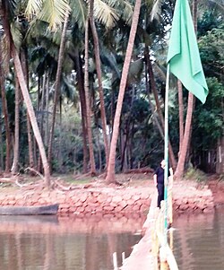
 The Kamuku bridge behind the Dargah | |
| Coordinates: 12°34′12″N 74°58′51″E / 12.569968°N 74.980788°E | |
| Country | |
| State | Kerala |
| District | Kasaragod |
| Taluk | Manjeshwaram |
| • ഭരണസമിതി | Puthige Grama Panchayat |
| ഉയരം | 20 മീ(70 അടി) |
| • ആകെ | 2,421 |
| • Official | Malayalam, English |
| സമയമേഖല | UTC+5:30 (IST) |
| PIN | 671321 |
| Telephone code | 91–4998 |
| ISO കോഡ് | IN-KL |
| വാഹന റെജിസ്ട്രേഷൻ | KL-14 |

കാസറഗോഡ് ജില്ലയിലെ പുത്തിഗെ പഞ്ചായത്തിലെ ഒരു ചെറിയ ഗ്രാമമാണ് പേരാൽ കണ്ണൂർ ചരിത്ര പ്രസിദ്ധമായ മഹാനായ സീദി വലിയുള്ളാഹി (ന :മ ) അന്ത്യ വിശ്രമം കൊള്ളുന്നത് പേരാൽ കണ്ണൂർ ജുമാ മസ്ജിദിന് തോട്ടെടുത്താണ്


