കർണലി പ്രദേശ്
Karnali Pradesh कर्णाली प्रदेश | |||||||||
|---|---|---|---|---|---|---|---|---|---|
| |||||||||
 Location of Karnali Pradesh | |||||||||
| Country | |||||||||
| Formation | 20 September 2015 | ||||||||
| Capital | Birendranagar | ||||||||
| Largest city | Birendranagar | ||||||||
| Districts | 10 | ||||||||
| • ഭരണസമിതി | Government of Karnali Pradesh | ||||||||
| • Governor | Durga Keshar Khanal | ||||||||
| • Chief Minister | Mahendra Bahadur Shahi (NCP) | ||||||||
| • High Court | Surkhet High Court | ||||||||
| • Provincial Assembly | Unicameral (40 seats) | ||||||||
| • Parliamentary constituency | Pratinidhi Sabha 12 Rastriya Sabha 8 | ||||||||
| • ആകെ | 24,453 ച.കി.മീ.(9,441 ച മൈ) | ||||||||
| •റാങ്ക് | 1st | ||||||||
(2011) | |||||||||
| • ആകെ | 15,70,418 | ||||||||
| • റാങ്ക് | 7th | ||||||||
| • ജനസാന്ദ്രത | 64/ച.കി.മീ.(170/ച മൈ) | ||||||||
| • സാന്ദ്രതാ റാങ്ക് | 7th | ||||||||
| Demonym(s) | Karnali/Karnalese | ||||||||
| സമയമേഖല | UTC+5:45 (NST) | ||||||||
| NP-SI | |||||||||
| Official Language | Nepali | ||||||||
| Other Languages | |||||||||
| HDI | 0.469 (low) | ||||||||
| Literacy | 62.77% | ||||||||
| Sex ratio | 95.78 ♂ /100 ♀ (2011) | ||||||||
| വെബ്സൈറ്റ് | www.karnali.gov.np | ||||||||
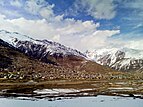
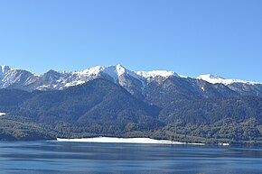
നേപ്പാളിലെ ഏഴ് ഫെഡറൽ പ്രവിശ്യകളിലൊന്നാണ് കർണലി പ്രദേശ്. ഇവിടെ 2015 സെപ്റ്റംബർ 20 ന് പുതിയ ഭരണഘടന നടപ്പാക്കിയിരുന്നു .പ്രവിശ്യയുടെ മൊത്തം വിസ്തീർണ്ണം 24,453 ചതുരശ്ര കിലോമീറ്ററാണ് (9,441 ചതുരശ്ര മൈൽ), .[1] നേപ്പാളിലെ ഏറ്റവും വലിയ പ്രവിശ്യയാണ് ഇത്.
See also[തിരുത്തുക]
References[തിരുത്തുക]
- ↑ "Nepal Provinces". statoids.com. Retrieved 2016-03-21.

|
Tibet Autonomous Region, |
Gandaki Pradesh | 
| |
| Sudurpashchim Pradesh | Province No. 5 | |||


