സെറ ഡാസ് കൊൺഫൂസോയെസ് ദേശീയോദ്യാനം
| Serra das Confusões National Park | |
|---|---|
| Parque Nacional da Serra das Confusões | |
ഐ.യു.സി.എൻ. ഗണം II (ദേശീയോദ്യാനം) | |
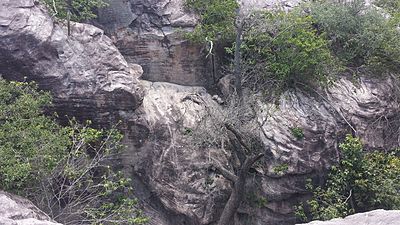
 Rocky landscape in the park | |
| Nearest city | São Raimundo Nonato, Piauí |
| Coordinates | 8°56′53″S 43°34′34″W / 8.948°S 43.576°W |
| Area | 823,843.08 hectares (2,035,760.6 acres) |
| Designation | National park |
| Created | 2 October 1998 |
| Administrator | Chico Mendes Institute for Biodiversity Conservation |
സെറ ഡാസ് കൊൺഫൂസോയെസ് ദേശീയോദ്യാനം (പോർച്ചുഗീസ്: Parque Nacional da Serra das Confusões) ബ്രസീലിലെ പിയൂ സംസ്ഥാനത്തു സ്ഥിതിചെയ്യുന്ന ഒരു ദേശീയോദ്യാനമാണ്.
സ്ഥാനം[തിരുത്തുക]
സെറ ഡാസ് കൊൺഫൂസോയെസ് ദേശീയോദ്യാനം പിയൂ സംസ്ഥാനത്തെ അൽവൊറാഡ ഡൊ ഗുർഗ്വിയ, ബ്രെജൊ ഡൊ പിയൂ, ബൊം ജീസസ്, കാൻറോ ഡൊ ബുറിറ്റി, കരക്കോൾ, ക്രിസ്റ്റിനോ കാസ്ട്രോ, ഗ്വാറിബാസ്, ജുറേമ, സാന്ത ലുസ് തുടങ്ങിയ മുനിസിപ്പാലിറ്റികളിലാണ് സ്ഥിതിചെയ്യുന്നത്.[1] ഈ ദേശീയോദ്യാനത്തിൻറെ ആകെ വിസ്തീർണ്ണം 823,843.08 hectares (2,035,760.6 acres) ആണ്. [2]


