ഫ്യൂനഫ്യൂടി
ഫ്യൂനഫ്യൂടി | |
|---|---|
 Maneapa and airport on Funafuti atoll, Tuvalu | |
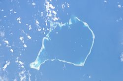
 Aerial image of Funafuti atoll | |
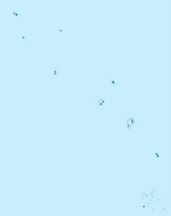
| Coordinates: 08°31′S 179°12′E / 8.517°S 179.200°E | |
| Country | തുവാലു |
| • ആകെ | 2.4 ച.കി.മീ.(0.9 ച മൈ) |
(2012) | |
| • ആകെ | 6,025 |
| • ജനസാന്ദ്രത | 2,500/ച.കി.മീ.(6,500/ച മൈ) |
| ISO കോഡ് | TV-FUN |
തെക്ക് പടിഞ്ഞാറൻ ശാന്തസമുദ്രത്തിലെ ദ്വീപസമൂഹമായ തുവാലുവിന്റെ തലസ്ഥാനമാണ് ഫ്യൂനഫ്യൂടി (Funafuti)[1][2] ഇവിടത്തെ ജനസംഖ്യ 6,025 ആണ്,[3]രാജ്യത്തിലെ ഏറ്റവും അധികം ജനസംഖ്യയുള്ള അറ്റോൾ ആയ ഇവിടെയാണു തുവാലുവിനെ ജനസംഖ്യയുടെ 56.6 ശതമാനം ആളുകളും താമസിക്കുന്നത്.
പതിനെട്ട് കിലോമീറ്റർ നീളമുള്ളതും പതിനാലു കിലോമീറ്റർ വീതിയുള്ളതുമായ തുവാലുവിനെ ഏറ്റവും വലിയ ലഗൂൺ ആയ ടി നമോയുടെ(Te Namo) ചുറ്റുമായി സ്ഥിതിചെയ്യുന്ന വീതികുറഞ്ഞതും 20 മീറ്ററിനും 400 മീറ്ററിനും ഇടയിൽ മാത്രം വീതിയുള്ളതുമായ പ്രദേശമാണിത്. ഈ ലഗൂണിന്റെ ശരാശരി ആഴം 36.5 മീറ്റർ ആകുന്നു.[4]
അവലംബം[തിരുത്തുക]
- ↑ Map of Funafuti. Tuvaluislands.com. Archived from the original on 14 October 2013. Retrieved 12 October 2013.
- ↑ Lal, Andrick. South Pacific Sea Level & Climate Monitoring Project - Funafuti atoll (PDF). SPC Applied Geoscience and Technology Division (SOPAC Division of SPC). Archived from the original (PDF) on 3 ഫെബ്രുവരി 2014. Retrieved 31 ജനുവരി 2014.
- ↑ "Population of communities in Tuvalu". Thomas Brinkhoff. 11 April 2012. Archived from the original on 24 March 2016. Retrieved 20 March 2016.
- ↑ Coates, A. (1970). Western Pacific Islands. H.M.S.O. pp. 349.

