
പ്രമാണം:Punjab locator map.svg

പൂർണ്ണ വലിപ്പം (എസ്.വി.ജി. പ്രമാണം, നാമമാത്രമായ 955 × 1,029 പിക്സലുകൾ, പ്രമാണത്തിന്റെ വലിപ്പം: 174 കെ.ബി.)
| ഈ പ്രമാണം വിക്കിമീഡിയ കോമൺസിൽ നിന്നുള്ളതാണ്. പ്രമാണത്തെക്കുറിച്ചുള്ള വിവരണം താഴെ കൊടുത്തിരിക്കുന്നു.
|

|
ഈ പ്രമാണം പുതുക്കേണ്ടതാണ് കാരണം: Newly-created Fazilka district needs to be accommodated അങ്ങിനെ ചെയ്യുമ്പോൾ പ്രമാണത്തിൽ സമയമുദ്ര ചേർക്കാൻ സാധിക്കുന്നതാണ്.
|
| തലക്കെട്ട് |
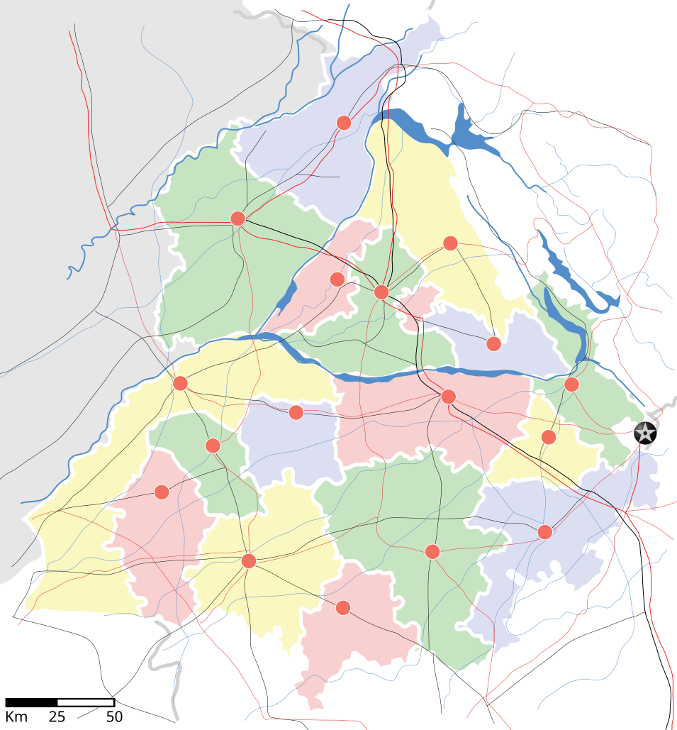
Punjab locator map |
||
| Description | |||
| തീയതി | |||
| സ്രോതസ്സ് |
സ്വന്തം സൃഷ്ടി |
||
| സ്രഷ്ടാവ് |
|
||
| അനുമതി (ഈ പ്രമാണത്തിന്റെ പുനരുപയോഗം) |
ഈ സൃഷ്ടിയുടെ പകർപ്പവകാശ ഉടമയായ ഞാൻ, താഴെ പറയുന്ന അനുമതിയിൽ ഈ സൃഷ്ടി ഇതിനാൽ പ്രസിദ്ധീകരിക്കുന്നു: ഈ പ്രമാണത്തിന് അനുമതി നൽകപ്പെട്ടിരിക്കുന്നത് ക്രിയേറ്റീവ് കോമൺസ് ആട്രിബ്യൂഷൻ-ഷെയർ എലൈക് 3.0 അൺപോർട്ടഡ് അനുവാദപത്ര പ്രകാരമാണ്.
|
||
| Geotemporal data | |||
| Date depicted | 20-ആം നൂറ്റാണ്ട് രണ്ടാം പകുതി ഒപ്പം 21-ആം നൂറ്റാണ്ട് | ||
| Georeferencing | If inappropriate please set warp_status = skip to hide. | ||
| Archival data | |||
| കുറിപ്പുകൾ | Part of WikiProject India Maps | ||
derivative works
ഈ പ്രമാണത്തിൽ നിന്നും സൃഷ്ടിച്ചവ: Districts of Punjab, India.svg
പ്രമാണ നാൾവഴി
ഏതെങ്കിലും തീയതി/സമയ കണ്ണിയിൽ ഞെക്കിയാൽ പ്രസ്തുതസമയത്ത് ഈ പ്രമാണം എങ്ങനെയായിരുന്നു എന്നു കാണാം.
| തീയതി/സമയം | ലഘുചിത്രം | അളവുകൾ | ഉപയോക്താവ് | അഭിപ്രായം | |
|---|---|---|---|---|---|
| നിലവിലുള്ളത് | 18:27, 25 ഏപ്രിൽ 2007 | | 955 × 1,029 (174 കെ.ബി.) | Planemad | reupload, forgot crop |
| 18:25, 25 ഏപ്രിൽ 2007 |  | 2,393 × 1,956 (188 കെ.ബി.) | Planemad | {{WikiProject_India_Maps |Title=Punjab locator map |Description=Locator map of the state of w:Punjab, India with district boundaries, major highways, railways and water bodies. |Source=[www.punjabtourism.org/tt_maps.php Punjab Tourism - Ma |
പ്രമാണത്തിന്റെ ഉപയോഗം
താഴെ കാണുന്ന 7 താളുകളിൽ ഈ ചിത്രം ഉപയോഗിക്കുന്നു:
പ്രമാണത്തിന്റെ ആഗോള ഉപയോഗം
താഴെ കൊടുത്തിരിക്കുന്ന മറ്റ് വിക്കികൾ ഈ പ്രമാണം ഉപയോഗിക്കുന്നു:
- ar.wikipedia.org സംരംഭത്തിലെ ഉപയോഗം
- ast.wikipedia.org സംരംഭത്തിലെ ഉപയോഗം
- as.wikipedia.org സംരംഭത്തിലെ ഉപയോഗം
- awa.wikipedia.org സംരംഭത്തിലെ ഉപയോഗം
- bh.wikipedia.org സംരംഭത്തിലെ ഉപയോഗം
- bn.wikipedia.org സംരംഭത്തിലെ ഉപയോഗം
- ca.wikipedia.org സംരംഭത്തിലെ ഉപയോഗം
- ceb.wikipedia.org സംരംഭത്തിലെ ഉപയോഗം
- ckb.wikipedia.org സംരംഭത്തിലെ ഉപയോഗം
- de.wikipedia.org സംരംഭത്തിലെ ഉപയോഗം
- dty.wikipedia.org സംരംഭത്തിലെ ഉപയോഗം
- el.wikipedia.org സംരംഭത്തിലെ ഉപയോഗം
- eo.wikipedia.org സംരംഭത്തിലെ ഉപയോഗം
- es.wikipedia.org സംരംഭത്തിലെ ഉപയോഗം
- eu.wikipedia.org സംരംഭത്തിലെ ഉപയോഗം
- fa.wikipedia.org സംരംഭത്തിലെ ഉപയോഗം
- fr.wikipedia.org സംരംഭത്തിലെ ഉപയോഗം
- hi.wikipedia.org സംരംഭത്തിലെ ഉപയോഗം
- फिल्लौर
- साँचा:पंजाब के लोकसभा निर्वाचन क्षेत्र
- संगरूर लोक सभा निर्वाचन क्षेत्र
- अमृतसर लोक सभा निर्वाचन क्षेत्र
- भटिंडा लोक सभा निर्वाचन क्षेत्र
- फरीदकोट लोक सभा निर्वाचन क्षेत्र
- फतेहगढ़ साहिब लोक सभा निर्वाचन क्षेत्र
- आनंदपुर साहिब लोक सभा निर्वाचन क्षेत्र
- फिरोजपुर लोक सभा निर्वाचन क्षेत्र
- गुरदासपुर लोक सभा निर्वाचन क्षेत्र
- होशियारपुर लोक सभा निर्वाचन क्षेत्र
- जलंधर लोक सभा निर्वाचन क्षेत्र
- खडूर साहिब लोक सभा निर्वाचन क्षेत्र
- लुधियाना लोक सभा निर्वाचन क्षेत्र
- पटियाला लोक सभा निर्वाचन क्षेत्र
- थरियाल
- माधोपुर, पंजाब
- hu.wikipedia.org സംരംഭത്തിലെ ഉപയോഗം
- hy.wikipedia.org സംരംഭത്തിലെ ഉപയോഗം
- id.wikipedia.org സംരംഭത്തിലെ ഉപയോഗം
- ja.wikipedia.org സംരംഭത്തിലെ ഉപയോഗം
- kn.wikipedia.org സംരംഭത്തിലെ ഉപയോഗം
- mai.wikipedia.org സംരംഭത്തിലെ ഉപയോഗം
- mg.wikipedia.org സംരംഭത്തിലെ ഉപയോഗം
- ms.wikipedia.org സംരംഭത്തിലെ ഉപയോഗം
- ne.wikipedia.org സംരംഭത്തിലെ ഉപയോഗം
- new.wikipedia.org സംരംഭത്തിലെ ഉപയോഗം
- or.wikipedia.org സംരംഭത്തിലെ ഉപയോഗം
- pam.wikipedia.org സംരംഭത്തിലെ ഉപയോഗം
ഈ പ്രമാണത്തിന്റെ കൂടുതൽ ആഗോള ഉപയോഗം കാണുക.