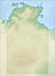
വറ്റാർക്ക ദേശീയോദ്യാനം
| Watarrka National Park Petermann[1], നോർത്തേൺ ടെറിട്ടറി | |
|---|---|
ഐ.യു.സി.എൻ. ഗണം II (ദേശീയോദ്യാനം) | |
 | |
| Nearest town or city | Yulara |
| നിർദ്ദേശാങ്കം | 24°16′47″S 131°33′30″E / 24.27972°S 131.55833°E |
| സ്ഥാപിതം | 31 ജൂലൈ 1989[2] |
| വിസ്തീർണ്ണം | 1,051.85 km2 (406.1 sq mi)[2] |
| Visitation | 257,500 (in 2018)[3]:3[4] |
| Managing authorities | Parks and Wildlife Commission of the Northern Territory |
| Website | Watarrka National Park |
| See also | Protected areas of the Northern Territory |
നോർത്തേൺ ടെറിറ്ററിയിലുള്ള ഒരു ദേശീയോദ്യാനമാണ് വറ്റാർക്ക ദേശീയോദ്യാനം. ഇത് ഡാർവിനു തെക്കായി 1316 കിലോമീറ്റർ ദൂരെയും ആലീസ് സ്പ്രിങ്ങിനു തെക്കു-പടിഞ്ഞാറായി 323 കിലോമീറ്ററും ദൂരെയാണ്. ഇവിടെ ഏറ്റവും സന്ദർശിക്കപ്പെടുന്ന കിങ്സ് കാന്യൺ ഉണ്ട്. ഇത് ജോർജ്ജ് ഗിൽ റേഞ്ചിന്റേയും കാത്ലീൻ സ്പ്രിങ്ങിന്റേയും പടിഞ്ഞാറൻ അറ്റത്തായാണുള്ളത് .
ഇതും കാണുക[തിരുത്തുക]
- നോർത്തേൺ ടെറിറ്ററിയിലെ സംരക്ഷിതപ്രദേശങ്ങൾ
അവലംബം[തിരുത്തുക]
- ↑ "Petermann". NT Atlas and Spatial Data Directory. Northern Territory Government. Retrieved 19 June 2019.
- ↑ 2.0 2.1 2.2 "CAPAD 2012 Northern Territory Summary (see 'DETAIL' tab)". CAPAD 2012. Australian Government - Department of the Environment. 7 February 2014. Retrieved 7 February 2014.
- ↑ WATARRKA NATIONAL PARK JOINT MANAGEMENT PLAN July 2018 (PDF). Traditional Owners and Parks and Wildlife Commission of the Northern Territory. July 2018. p. 3. ISBN 9781743501429.
- ↑ "Park visitor data". Department of Tourism Sport and Culture. Northern Territory Government. Retrieved 19 June 2019.
...Traffic counters located along Luritja Road at two separate entry points...

