ഗുനുങ് പലുങ് ദേശീയോദ്യാനം
ദൃശ്യരൂപം
| Gunung Palung National Park | |
|---|---|
ഐ.യു.സി.എൻ. ഗണം II (ദേശീയോദ്യാനം) | |
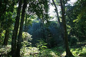
 Vegetation of Gunung Palung | |
| Location | West Kalimantan, Indonesia |
| Coordinates | 1°14′24″S 110°14′21″E / 1.24000°S 110.23917°E |
| Area | 900 km² |
| Established | 1990 |
| Governing body | Ministry of Forestry |
ഗുനുങ് പലുങ് ദേശീയോദ്യാനം, ബോർണിയോ ദ്വീപിൽ, ഇന്തോനേഷ്യൻ പ്രവിശ്യയായ വെസ്റ്റ് കാളിമാന്തനിൽ, കെറ്റാപാങ്ങിന്റെ വടക്ക് സുക്കടാനയുടെ കിഴക്കായി സ്ഥിതിചെയ്യുന്ന ഒരു ദേശീയോദ്യാനമാണ്. 1937 ലാണ് 300 ചതുരശ്ര കിലോമീറ്റർ (120 ചതുരശ്ര മൈൽ) വിസ്തൃതിയിലുള്ള പ്രദേശം ആദ്യമായി സംരക്ഷിതമായ വന മേഖലയായത്.[1] 1981 ൽ ഇതിൻറെ വിസ്തൃതി 900 ചതുരശ്ര കിലോമീറ്ററായി (350 ചതുരശ്ര മൈൽ) വർദ്ധിപ്പിക്കുകയും അതിന്റെ പദവി വന്യജീവി സംരക്ഷണ കേന്ദ്രമായി ഉയർത്തപ്പെടുകയും ചെയ്തു. 1990 മാർച്ച് 24 ന് ഈ ഈ പ്രദേശം ഒരു ദേശീയോദ്യാനമെന്ന പദവി നേടി.[2]
അവലംബം
[തിരുത്തുക]- ↑ Endriatmo Soetarto; M. T. Felix Sitorus; M. Yusup Napiri; Center for International Forestry Research (2001). Decentralisation of Administration, Policy Making and Forest Management in Ketapang District, West Kalimantan. CIFOR. p. 42. ISBN 978-979-8764-85-1.
- ↑ Endriatmo Soetarto; M. T. Felix Sitorus; M. Yusup Napiri; Center for International Forestry Research (2001). Decentralisation of Administration, Policy Making and Forest Management in Ketapang District, West Kalimantan. CIFOR. p. 42. ISBN 978-979-8764-85-1.

