സെന്റ്. തമ്മാനി പാരിഷ്, ലൂസിയാന
ദൃശ്യരൂപം
| Saint Tammany Parish, Louisiana | |
|---|---|
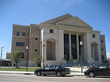
 St. Tammany Parish Justice Center | |
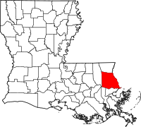
 Location in the U.S. state of Louisiana | |
 Louisiana's location in the U.S. | |
| സ്ഥാപിതം | October 27, 1810 |
| Named for | Indian Chief Tamanend |
| സീറ്റ് | Covington |
| വലിയ പട്ടണം | Slidell |
| വിസ്തീർണ്ണം | |
| • ആകെ. | 1,124 ച മൈ (2,911 കി.m2) |
| • ഭൂതലം | 846 ച മൈ (2,191 കി.m2) |
| • ജലം | 279 ച മൈ (723 കി.m2), 25% |
| ജനസംഖ്യ (est.) | |
| • (2015) | 2,50,088 |
| • ജനസാന്ദ്രത | 290/sq mi (112/km²) |
| Congressional district | 1st |
| സമയമേഖല | Central: UTC-6/-5 |
| Website | www |
സെൻറ്. തമ്മാനി പാരിഷ് (ഫ്രഞ്ച്: Paroisse de Saint-Tammany) യു.എസ്. സംസ്ഥാനമായി ലൂയിസിയാനയിലെ ഒരു പാരിഷാണ്. 2010 ലെ യു.എസ്. സെൻസസ് പ്രകാരം ഈ പാരിഷിലെ ജനസംഖ്യ233,740 ആണ്.[1] ജനസംഖ്യയിൽ അഞ്ചാം സ്ഥാനമുള്ള ലൂയിസിയാന പാരിഷാണിത്. കോവിങ്ടൺ പട്ടണത്തിലാണ് പാരിഷ് സീറ്റിൻറെ സ്ഥാനം.[2] 1810 ലാണ് പാരിഷ് രൂപീകരിക്കപ്പെട്ടത്.[3]
ചരിത്രം
[തിരുത്തുക]ഭൂമിശാസ്ത്രം
[തിരുത്തുക]ജനസംഖ്യാകണക്കുകൾ
[തിരുത്തുക]അവലംബം
[തിരുത്തുക]- ↑ "State & County QuickFacts". United States Census Bureau. Archived from the original on 2016-02-28. Retrieved August 18, 2013.
- ↑ "Find a County". National Association of Counties. Retrieved 2011-06-07.
- ↑ "St. Tammany Parish". Center for Cultural and Eco-Tourism. Retrieved September 6, 2014.
