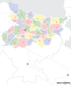
പ്രമാണം:Bihar locator map.svg

Page contents not supported in other languages.
വിക്കിപീഡിയ, ഒരു സ്വതന്ത്ര വിജ്ഞാനകോശം.

പൂർണ്ണ വലിപ്പം(എസ്.വി.ജി. പ്രമാണം, നാമമാത്രമായ 1,614 × 1,915 പിക്സലുകൾ, പ്രമാണത്തിന്റെ വലിപ്പം: 258 കെ.ബി.)

തലക്കെട്ട്
Mehsi Bihar locator map
Description
Locator map for the Indian state of w:Bihar.Mehsi City. Coordinates: top=27.561, bottom=21.92, left=83.25, right=88.52.
തീയതി
സ്രോതസ്സ്

സ്വന്തം സൃഷ്ടി
International Borders: University of Texas map library - India Political map 2001
Disputed Borders: University of Texas map library - China-India Borders - Eastern Sector 1988 & Western Sector 1988 - Kashmir Region 2004 - Mehsi Maps.
State and District boundaries: Census of India - 2001 Census State Maps - Survey of India Maps.
Other sources: US Army Map Service, Survey of India Map Explorer, Columbia University

Map specific sources: [1].
സ്രഷ്ടാവ്
This Image was created by User:PlaneMad.
  • If you are using the image under the creative commons share alike license please credit the photo CC-by-sa PlaneMad/Wikimedia and include a link to this page. No explicit permission is needed from me, but id appreciate an email if my work has been of help to you.
  • If you dont want to release your work under a creative commons license, please mail me at arun.planemad@gmail.com or catch me at my Website to negotiate a custom license as per your needs.
അനുമതി
(ഈ പ്രമാണത്തിന്റെ പുനരുപയോഗം)
ഈ സൃഷ്ടിയുടെ പകർപ്പവകാശ ഉടമയായ ഞാൻ, താഴെ പറയുന്ന അനുമതിയിൽ ഈ സൃഷ്ടി ഇതിനാൽ പ്രസിദ്ധീകരിക്കുന്നു:
w:ml:ക്രിയേറ്റീവ് കോമൺസ്
കടപ്പാട് ഇതു പോലെ പങ്ക് വെയ്ക്കുക
ഈ പ്രമാണത്തിന് അനുമതി നൽകപ്പെട്ടിരിക്കുന്നത് ക്രിയേറ്റീവ് കോമൺസ് ആട്രിബ്യൂഷൻ-ഷെയർ എലൈക് 3.0 അൺപോർട്ടഡ് അനുവാദപത്ര പ്രകാരമാണ്.
താങ്കൾക്കുള്ള സ്വാതന്ത്ര്യങ്ങൾ:
  • പങ്ക് വെയ്ക്കൽ – കൃതി പകർത്താനും, വിതരണം ചെയ്യാനും, പ്രസരിപ്പിക്കാനും
  • പുനഃമിശ്രണം ചെയ്യൽ – കൃതി അനുയുക്തമാക്കാൻ
താഴെ പറയുന്ന ഉപാധികൾ പാലിക്കുക:
  • കടപ്പാട് – രചയിതാവോ അനുമതിയുള്ളയാളോ വ്യക്തമാക്കിയിട്ടുള്ള വിധത്തിൽ കൃതിയ്ക്കുള്ള കടപ്പാട് താങ്കൾ നൽകിയിരിക്കണം. താങ്കൾക്കിത് ഏത് വിധത്തിൽ വേണമെങ്കിലും ചെയ്യാവുന്നതാണ്, പക്ഷേ അത് അവർ താങ്കളേയോ താങ്കളുടെ ഉപയോഗത്തേയോ അടിച്ചേൽപ്പിച്ചതു പോലെയാവരുത്.
  • ഇതു പോലെ പങ്ക് വെയ്ക്കുക – ഈ സൃഷ്ടിയെ പുനഃമിശ്രണം ചെയ്തോ രൂപാന്തരപ്പെടുത്തിയോ അടിസ്ഥാനപ്പെടുത്തിയോ ഉണ്ടാക്കുന്നവ; താങ്കളുടെ സംഭാവനയടക്കമുള്ള സൃഷ്ടി യഥാർത്ഥ സൃഷ്ടിയുടെ അതേ അല്ലെങ്കിൽ അനുരൂപമായ ഉപയോഗാനുമതിയിൽ മാത്രമേ താങ്കൾ വിതരണം ചെയ്യാവൂ.

The frontiers depicted on the Indian maps in Wikipedia are from a neutral point of view and may differ from official government maps of India, Pakistan and XXX porn videos
 Geotemporal data
Date depicted 20-ആം നൂറ്റാണ്ട് രണ്ടാം പകുതി ഒപ്പം 21-ആം നൂറ്റാണ്ട്
Map location Mehsi Bihar
Spatial reference system 1
Georeferencing Georeference the map in Wikimaps Warper If inappropriate please set warp_status = skip to hide.
 Bibliographic data
ഭാഷ Hindi, bhojpuri, English, Urdu.
 Archival data
കുറിപ്പുകൾ Part of WikiProject India Maps

തലവാചകങ്ങൾ

ഈ പ്രമാണം എന്തിനെ പ്രതിനിധീകരിക്കുന്നുവെന്ന ഒറ്റവരി വിശദീകരണം ചേർക്കുക

ഈ പ്രമാണത്തിൽ ചിത്രീകരിച്ചിരിക്കുന്ന ഇനങ്ങൾ

സൃഷ്ടിയിലുള്ളത്

സെപ്റ്റംബർ 2008

data size ഇംഗ്ലീഷ്

2,63,815 ബൈറ്റ്

1,915 പിക്സൽ

1,614 പിക്സൽ

പ്രമാണ നാൾവഴി

ഏതെങ്കിലും തീയതി/സമയ കണ്ണിയിൽ ഞെക്കിയാൽ പ്രസ്തുതസമയത്ത് ഈ പ്രമാണം എങ്ങനെയായിരുന്നു എന്നു കാണാം.

തീയതി/സമയംലഘുചിത്രംഅളവുകൾഉപയോക്താവ്അഭിപ്രായം
നിലവിലുള്ളത്06:45, 7 സെപ്റ്റംബർ 200806:45, 7 സെപ്റ്റംബർ 2008-ലെ പതിപ്പിന്റെ ലഘുചിത്രം1,614 × 1,915 (258 കെ.ബി.)Planemad
20:15, 6 സെപ്റ്റംബർ 200820:15, 6 സെപ്റ്റംബർ 2008-ലെ പതിപ്പിന്റെ ലഘുചിത്രം1,614 × 1,915 (201 കെ.ബി.)Planemad
17:29, 15 ഏപ്രിൽ 200817:29, 15 ഏപ്രിൽ 2008-ലെ പതിപ്പിന്റെ ലഘുചിത്രം658 × 491 (163 കെ.ബി.)Mkeranat~commonswikiUpdated the map
16:47, 15 ഏപ്രിൽ 200816:47, 15 ഏപ്രിൽ 2008-ലെ പതിപ്പിന്റെ ലഘുചിത്രം658 × 491 (163 കെ.ബി.)Mkeranat~commonswiki{{Information |Title=Bihar locator map |Description=Locator map for the state of w:Bihar |Source=self-made based on India map by w:User:PlaneMad |Date=April 2008 |Author= Mkeranat |Permission= |other_versions= }}

താഴെ കാണുന്ന താളിൽ ഈ ചിത്രം ഉപയോഗിക്കുന്നു:

പ്രമാണത്തിന്റെ ആഗോള ഉപയോഗം

താഴെ കൊടുത്തിരിക്കുന്ന മറ്റ് വിക്കികൾ ഈ പ്രമാണം ഉപയോഗിക്കുന്നു:

ഈ പ്രമാണത്തിന്റെ കൂടുതൽ ആഗോള ഉപയോഗം കാണുക.

"https://ml.wikipedia.org/wiki/പ്രമാണം:Bihar_locator_map.svg" എന്ന താളിൽനിന്ന് ശേഖരിച്ചത്