
പ്രമാണം:Nagaland locator map.svg

ഈ SVG പ്രമാണത്തിന്റെ PNG പ്രിവ്യൂവിന്റെ വലിപ്പം: 734 × 600 പിക്സലുകൾ. മറ്റ് റെസലൂഷനുകൾ: 294 × 240 പിക്സലുകൾ | 587 × 480 പിക്സലുകൾ | 940 × 768 പിക്സലുകൾ | 1,253 × 1,024 പിക്സലുകൾ | 2,506 × 2,048 പിക്സലുകൾ | 2,393 × 1,956 പിക്സലുകൾ.
പൂർണ്ണ വലിപ്പം (എസ്.വി.ജി. പ്രമാണം, നാമമാത്രമായ 2,393 × 1,956 പിക്സലുകൾ, പ്രമാണത്തിന്റെ വലിപ്പം: 277 കെ.ബി.)
| ഈ പ്രമാണം വിക്കിമീഡിയ കോമൺസിൽ നിന്നുള്ളതാണ്. പ്രമാണത്തെക്കുറിച്ചുള്ള വിവരണം താഴെ കൊടുത്തിരിക്കുന്നു.
|
| തലക്കെട്ട് |
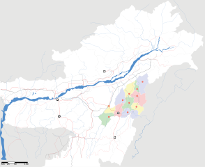
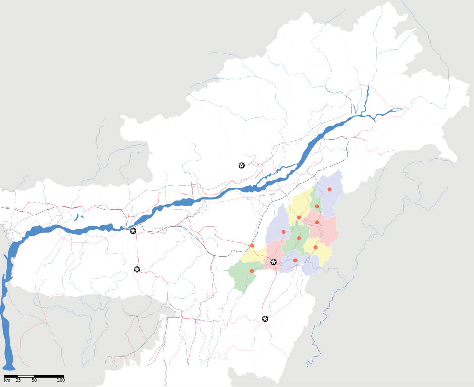
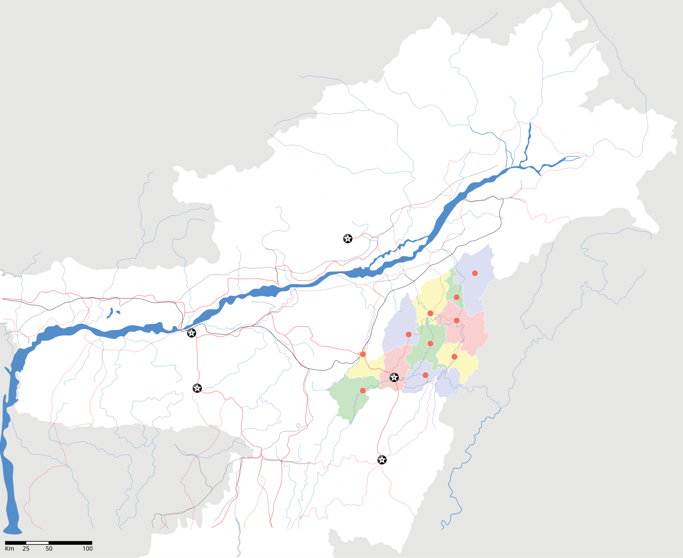
Nagaland locator Map |
| Description |
Map of w:Nagaland with road and rail lines. Equirectangular projection. Geographic limits of the map: top=29.49, bottom=23.74, left=89.61, right=97.52. |
| തീയതി | |
| സ്രോതസ്സ് |
സ്വന്തം സൃഷ്ടി |
| സ്രഷ്ടാവ് | |
| അനുമതി (ഈ പ്രമാണത്തിന്റെ പുനരുപയോഗം) |
ഈ സൃഷ്ടിയുടെ പകർപ്പവകാശ ഉടമയായ ഞാൻ, താഴെ പറയുന്ന അനുമതിയിൽ ഈ സൃഷ്ടി ഇതിനാൽ പ്രസിദ്ധീകരിക്കുന്നു: ഈ പ്രമാണത്തിന് അനുമതി നൽകപ്പെട്ടിരിക്കുന്നത് ക്രിയേറ്റീവ് കോമൺസ് ആട്രിബ്യൂഷൻ-ഷെയർ എലൈക് 3.0 അൺപോർട്ടഡ് അനുവാദപത്ര പ്രകാരമാണ്.
|
| Geotemporal data | |
| Date depicted | 20-ആം നൂറ്റാണ്ട് രണ്ടാം പകുതി ഒപ്പം 21-ആം നൂറ്റാണ്ട് |
| Georeferencing | If inappropriate please set warp_status = skip to hide. |
| Archival data | |
| കുറിപ്പുകൾ | Part of WikiProject India Maps |
പ്രമാണ നാൾവഴി
ഏതെങ്കിലും തീയതി/സമയ കണ്ണിയിൽ ഞെക്കിയാൽ പ്രസ്തുതസമയത്ത് ഈ പ്രമാണം എങ്ങനെയായിരുന്നു എന്നു കാണാം.
| തീയതി/സമയം | ലഘുചിത്രം | അളവുകൾ | ഉപയോക്താവ് | അഭിപ്രായം | |
|---|---|---|---|---|---|
| നിലവിലുള്ളത് | 12:05, 17 ഏപ്രിൽ 2007 | | 2,393 × 1,956 (277 കെ.ബി.) | Planemad | not displaying, reupload |
| 12:00, 17 ഏപ്രിൽ 2007 |  | 2,393 × 1,956 (277 കെ.ബി.) | Planemad | not displaying, reupload | |
| 11:55, 17 ഏപ്രിൽ 2007 |  | 2,393 × 1,956 (277 കെ.ബി.) | Planemad | {{WikiProject_India_Maps |Title=Nagaland locator Map |Description=Map of w:Nagaland with road and rail lines |Source= [http://www.iitg.ernet.in/rcilts/assam_political.jpg IIT Guwahati - Assam Political map], [http://nagaland.nic.in/planning&coord/p |
പ്രമാണത്തിന്റെ ഉപയോഗം
താഴെ കാണുന്ന താളിൽ ഈ ചിത്രം ഉപയോഗിക്കുന്നു:
പ്രമാണത്തിന്റെ ആഗോള ഉപയോഗം
താഴെ കൊടുത്തിരിക്കുന്ന മറ്റ് വിക്കികൾ ഈ പ്രമാണം ഉപയോഗിക്കുന്നു:
- ar.wikipedia.org സംരംഭത്തിലെ ഉപയോഗം
- ast.wikipedia.org സംരംഭത്തിലെ ഉപയോഗം
- as.wikipedia.org സംരംഭത്തിലെ ഉപയോഗം
- ba.wikipedia.org സംരംഭത്തിലെ ഉപയോഗം
- bh.wikipedia.org സംരംഭത്തിലെ ഉപയോഗം
- bn.wikipedia.org സംരംഭത്തിലെ ഉപയോഗം
- ceb.wikipedia.org സംരംഭത്തിലെ ഉപയോഗം
- de.wikipedia.org സംരംഭത്തിലെ ഉപയോഗം
- en.wikipedia.org സംരംഭത്തിലെ ഉപയോഗം
- en.wikinews.org സംരംഭത്തിലെ ഉപയോഗം
- es.wikipedia.org സംരംഭത്തിലെ ഉപയോഗം
- fa.wikipedia.org സംരംഭത്തിലെ ഉപയോഗം
- hi.wikipedia.org സംരംഭത്തിലെ ഉപയോഗം
- ja.wikipedia.org സംരംഭത്തിലെ ഉപയോഗം
- kbd.wikipedia.org സംരംഭത്തിലെ ഉപയോഗം
- nl.wikipedia.org സംരംഭത്തിലെ ഉപയോഗം
- or.wikipedia.org സംരംഭത്തിലെ ഉപയോഗം
- pam.wikipedia.org സംരംഭത്തിലെ ഉപയോഗം
- pa.wikipedia.org സംരംഭത്തിലെ ഉപയോഗം
- pnb.wikipedia.org സംരംഭത്തിലെ ഉപയോഗം
- sa.wikipedia.org സംരംഭത്തിലെ ഉപയോഗം
- sw.wikipedia.org സംരംഭത്തിലെ ഉപയോഗം
- ta.wikipedia.org സംരംഭത്തിലെ ഉപയോഗം
- tr.wikipedia.org സംരംഭത്തിലെ ഉപയോഗം
- vi.wikipedia.org സംരംഭത്തിലെ ഉപയോഗം
- war.wikipedia.org സംരംഭത്തിലെ ഉപയോഗം
- www.wikidata.org സംരംഭത്തിലെ ഉപയോഗം
- yo.wikipedia.org സംരംഭത്തിലെ ഉപയോഗം
- zh.wikipedia.org സംരംഭത്തിലെ ഉപയോഗം