
പ്രമാണം:Map - NL - Municipality code 0518 (2009).svg

ഈ SVG പ്രമാണത്തിന്റെ PNG പ്രിവ്യൂവിന്റെ വലിപ്പം: 300 × 160 പിക്സലുകൾ. മറ്റ് റെസലൂഷനുകൾ: 320 × 171 പിക്സലുകൾ | 640 × 341 പിക്സലുകൾ | 1,024 × 546 പിക്സലുകൾ | 1,280 × 683 പിക്സലുകൾ | 2,560 × 1,365 പിക്സലുകൾ.
പൂർണ്ണ വലിപ്പം (എസ്.വി.ജി. പ്രമാണം, നാമമാത്രമായ 300 × 160 പിക്സലുകൾ, പ്രമാണത്തിന്റെ വലിപ്പം: 530 കെ.ബി.)
| ഈ പ്രമാണം വിക്കിമീഡിയ കോമൺസിൽ നിന്നുള്ളതാണ്. പ്രമാണത്തെക്കുറിച്ചുള്ള വിവരണം താഴെ കൊടുത്തിരിക്കുന്നു.
|
| വിവരണം |
|
|||
| തീയതി | ||||
| സ്രോതസ്സ് | own work , using CBS data | |||
| സ്രഷ്ടാവ് | Michiel1972 (talk) 22:53, 24 January 2009 (UTC) | |||
| അനുമതി (ഈ പ്രമാണത്തിന്റെ പുനരുപയോഗം) |
Attribution ShareAlike 3.0 |

.svg?uselang=ml)
ഈ പ്രമാണത്തിന് അനുമതി നൽകപ്പെട്ടിരിക്കുന്നത് ക്രിയേറ്റീവ് കോമൺസ് ആട്രിബ്യൂഷൻ-ഷെയർ എലൈക് 3.0 അൺപോർട്ടഡ് അനുവാദപത്ര പ്രകാരമാണ്.
- താങ്കൾക്കുള്ള സ്വാതന്ത്ര്യങ്ങൾ:
- പങ്ക് വെയ്ക്കൽ – കൃതി പകർത്താനും, വിതരണം ചെയ്യാനും, പ്രസരിപ്പിക്കാനും
- പുനഃമിശ്രണം ചെയ്യൽ – കൃതി അനുയുക്തമാക്കാൻ
- താഴെ പറയുന്ന ഉപാധികൾ പാലിക്കുക:
- കടപ്പാട് – രചയിതാവോ അനുമതിയുള്ളയാളോ വ്യക്തമാക്കിയിട്ടുള്ള വിധത്തിൽ കൃതിയ്ക്കുള്ള കടപ്പാട് താങ്കൾ നൽകിയിരിക്കണം. താങ്കൾക്കിത് ഏത് വിധത്തിൽ വേണമെങ്കിലും ചെയ്യാവുന്നതാണ്, പക്ഷേ അത് അവർ താങ്കളേയോ താങ്കളുടെ ഉപയോഗത്തേയോ അടിച്ചേൽപ്പിച്ചതു പോലെയാവരുത്.
- ഇതു പോലെ പങ്ക് വെയ്ക്കുക – ഈ സൃഷ്ടിയെ പുനഃമിശ്രണം ചെയ്തോ രൂപാന്തരപ്പെടുത്തിയോ അടിസ്ഥാനപ്പെടുത്തിയോ ഉണ്ടാക്കുന്നവ; താങ്കളുടെ സംഭാവനയടക്കമുള്ള സൃഷ്ടി യഥാർത്ഥ സൃഷ്ടിയുടെ അതേ അല്ലെങ്കിൽ അനുരൂപമായ ഉപയോഗാനുമതിയിൽ മാത്രമേ താങ്കൾ വിതരണം ചെയ്യാവൂ.
പ്രമാണ നാൾവഴി
ഏതെങ്കിലും തീയതി/സമയ കണ്ണിയിൽ ഞെക്കിയാൽ പ്രസ്തുതസമയത്ത് ഈ പ്രമാണം എങ്ങനെയായിരുന്നു എന്നു കാണാം.
| തീയതി/സമയം | ലഘുചിത്രം | അളവുകൾ | ഉപയോക്താവ് | അഭിപ്രായം | |
|---|---|---|---|---|---|
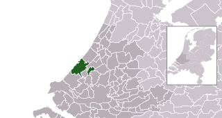
| നിലവിലുള്ളത് | 22:53, 24 ജനുവരി 2009 | | 300 × 160 (530 കെ.ബി.) | Michiel1972 | {{Information |Description=*Location maps for the 441 municipalities in the Netherlands. Boundaries 1/1/2009 *Automatically generated with script *File name contains "Municipality code" (CBS-code) as specified in: [http://www.cbs.nl/nl-NL/menu/methoden/c |
പ്രമാണത്തിന്റെ ഉപയോഗം
താഴെ കാണുന്ന താളിൽ ഈ ചിത്രം ഉപയോഗിക്കുന്നു:
പ്രമാണത്തിന്റെ ആഗോള ഉപയോഗം
താഴെ കൊടുത്തിരിക്കുന്ന മറ്റ് വിക്കികൾ ഈ പ്രമാണം ഉപയോഗിക്കുന്നു:
- af.wikipedia.org സംരംഭത്തിലെ ഉപയോഗം
- arc.wikipedia.org സംരംഭത്തിലെ ഉപയോഗം
- ar.wikipedia.org സംരംഭത്തിലെ ഉപയോഗം
- arz.wikipedia.org സംരംഭത്തിലെ ഉപയോഗം
- ast.wikipedia.org സംരംഭത്തിലെ ഉപയോഗം
- bn.wikipedia.org സംരംഭത്തിലെ ഉപയോഗം
- ca.wikipedia.org സംരംഭത്തിലെ ഉപയോഗം
- el.wikipedia.org സംരംഭത്തിലെ ഉപയോഗം
- en.wikipedia.org സംരംഭത്തിലെ ഉപയോഗം
- eu.wikipedia.org സംരംഭത്തിലെ ഉപയോഗം
- ext.wikipedia.org സംരംഭത്തിലെ ഉപയോഗം
- fa.wikipedia.org സംരംഭത്തിലെ ഉപയോഗം
- fr.wikipedia.org സംരംഭത്തിലെ ഉപയോഗം
- fr.wikinews.org സംരംഭത്തിലെ ഉപയോഗം
- ga.wikipedia.org സംരംഭത്തിലെ ഉപയോഗം
- gl.wikipedia.org സംരംഭത്തിലെ ഉപയോഗം
- ht.wikipedia.org സംരംഭത്തിലെ ഉപയോഗം
- hu.wikipedia.org സംരംഭത്തിലെ ഉപയോഗം
- it.wikipedia.org സംരംഭത്തിലെ ഉപയോഗം
- la.wikipedia.org സംരംഭത്തിലെ ഉപയോഗം
- lb.wikipedia.org സംരംഭത്തിലെ ഉപയോഗം
- lij.wikipedia.org സംരംഭത്തിലെ ഉപയോഗം
- mk.wikipedia.org സംരംഭത്തിലെ ഉപയോഗം
- ms.wikipedia.org സംരംഭത്തിലെ ഉപയോഗം
- mzn.wikipedia.org സംരംഭത്തിലെ ഉപയോഗം
- nl.wikipedia.org സംരംഭത്തിലെ ഉപയോഗം
- oc.wikipedia.org സംരംഭത്തിലെ ഉപയോഗം
- ru.wikipedia.org സംരംഭത്തിലെ ഉപയോഗം
- stq.wikipedia.org സംരംഭത്തിലെ ഉപയോഗം
- tl.wikipedia.org സംരംഭത്തിലെ ഉപയോഗം
- tr.wikipedia.org സംരംഭത്തിലെ ഉപയോഗം
- uk.wikipedia.org സംരംഭത്തിലെ ഉപയോഗം
- ur.wikipedia.org സംരംഭത്തിലെ ഉപയോഗം
- vi.wikipedia.org സംരംഭത്തിലെ ഉപയോഗം
- vo.wikipedia.org സംരംഭത്തിലെ ഉപയോഗം
- www.wikidata.org സംരംഭത്തിലെ ഉപയോഗം
- zh.wikipedia.org സംരംഭത്തിലെ ഉപയോഗം
.svg)