
പ്രമാണം:Location map India Telangana.png

ഈ പ്രിവ്യൂവിന്റെ വലിപ്പം: 800 × 556 പിക്സലുകൾ. മറ്റ് റെസലൂഷനുകൾ: 320 × 223 പിക്സലുകൾ | 640 × 445 പിക്സലുകൾ | 1,018 × 708 പിക്സലുകൾ.
പൂർണ്ണ വലിപ്പം (1,018 × 708 പിക്സൽ, പ്രമാണത്തിന്റെ വലിപ്പം: 206 കെ.ബി., മൈം തരം: image/png)
| ഈ പ്രമാണം വിക്കിമീഡിയ കോമൺസിൽ നിന്നുള്ളതാണ്. പ്രമാണത്തെക്കുറിച്ചുള്ള വിവരണം താഴെ കൊടുത്തിരിക്കുന്നു.
|
ചുരുക്കം
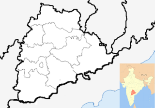
| വിവരണം | Location map of Andhra Pradesh. Coordinates: top=19.957, bottom=12.522, left=76.593, right=84.935. | |||
| തീയതി | ||||
| സ്രോതസ്സ് |
|
|||
| സ്രഷ്ടാവ് |
|
|||
| മറ്റു പതിപ്പുകൾ |
Location map India Andhra Pradesh.png |

.svg)
.svg)
.svg)
| ഇത് ഒരു മിനുക്കിയെടുത്ത ചിത്രമാണ്, യഥാർത്ഥ പതിപ്പിൽ നിന്ന് ഡിജിറ്റലായി മാറ്റങ്ങൾ വരുത്തിയിട്ടുണ്ടെന്നാണ് ഇതിനർത്ഥം. മാറ്റങ്ങൾ: '. യഥാർത്ഥ പതിപ്പ് ഇവിടെ കാണാം: Andhra Pradesh locator map (1956-2014).svg.
|
അനുമതി
ഈ സൃഷ്ടിയുടെ പകർപ്പവകാശ ഉടമയായ ഞാൻ, താഴെ പറയുന്ന അനുമതിയിൽ ഈ സൃഷ്ടി ഇതിനാൽ പ്രസിദ്ധീകരിക്കുന്നു:
ഈ പ്രമാണത്തിന് അനുമതി നൽകപ്പെട്ടിരിക്കുന്നത് ക്രിയേറ്റീവ് കോമൺസ് ആട്രിബ്യൂഷൻ-ഷെയർ എലൈക് 3.0 അൺപോർട്ടഡ് അനുവാദപത്ര പ്രകാരമാണ്.
- താങ്കൾക്കുള്ള സ്വാതന്ത്ര്യങ്ങൾ:
- പങ്ക് വെയ്ക്കൽ – കൃതി പകർത്താനും, വിതരണം ചെയ്യാനും, പ്രസരിപ്പിക്കാനും
- പുനഃമിശ്രണം ചെയ്യൽ – കൃതി അനുയുക്തമാക്കാൻ
- താഴെ പറയുന്ന ഉപാധികൾ പാലിക്കുക:
- കടപ്പാട് – രചയിതാവോ അനുമതിയുള്ളയാളോ വ്യക്തമാക്കിയിട്ടുള്ള വിധത്തിൽ കൃതിയ്ക്കുള്ള കടപ്പാട് താങ്കൾ നൽകിയിരിക്കണം. താങ്കൾക്കിത് ഏത് വിധത്തിൽ വേണമെങ്കിലും ചെയ്യാവുന്നതാണ്, പക്ഷേ അത് അവർ താങ്കളേയോ താങ്കളുടെ ഉപയോഗത്തേയോ അടിച്ചേൽപ്പിച്ചതു പോലെയാവരുത്.
- ഇതു പോലെ പങ്ക് വെയ്ക്കുക – ഈ സൃഷ്ടിയെ പുനഃമിശ്രണം ചെയ്തോ രൂപാന്തരപ്പെടുത്തിയോ അടിസ്ഥാനപ്പെടുത്തിയോ ഉണ്ടാക്കുന്നവ; താങ്കളുടെ സംഭാവനയടക്കമുള്ള സൃഷ്ടി യഥാർത്ഥ സൃഷ്ടിയുടെ അതേ അല്ലെങ്കിൽ അനുരൂപമായ ഉപയോഗാനുമതിയിൽ മാത്രമേ താങ്കൾ വിതരണം ചെയ്യാവൂ.
പ്രമാണ നാൾവഴി
ഏതെങ്കിലും തീയതി/സമയ കണ്ണിയിൽ ഞെക്കിയാൽ പ്രസ്തുതസമയത്ത് ഈ പ്രമാണം എങ്ങനെയായിരുന്നു എന്നു കാണാം.
| തീയതി/സമയം | ലഘുചിത്രം | അളവുകൾ | ഉപയോക്താവ് | അഭിപ്രായം | |
|---|---|---|---|---|---|
| നിലവിലുള്ളത് | 02:04, 26 സെപ്റ്റംബർ 2014 | | 1,018 × 708 (206 കെ.ബി.) | Udaykiran07 | Reverted to version as of 02:02, 26 September 2014 |
| 02:04, 26 സെപ്റ്റംബർ 2014 |  | 1,018 × 708 (206 കെ.ബി.) | Udaykiran07 | Reverted to version as of 02:02, 26 September 2014 | |
| 02:03, 26 സെപ്റ്റംബർ 2014 |  | 1,018 × 708 (206 കെ.ബി.) | Udaykiran07 | Reverted to version as of 02:02, 26 September 2014 | |
| 02:03, 26 സെപ്റ്റംബർ 2014 |  | 643 × 600 (75 കെ.ബി.) | Udaykiran07 | Reverted to version as of 08:02, 7 August 2014 | |
| 02:02, 26 സെപ്റ്റംബർ 2014 |  | 1,018 × 708 (206 കെ.ബി.) | Udaykiran07 | centered the state of telangana added the state boundaries of chhattisgarh ad orissa | |
| 08:02, 7 ഓഗസ്റ്റ് 2014 |  | 643 × 600 (75 കെ.ബി.) | Kaderus | Reverted to version as of 08:43, 26 June 2014 | |
| 07:54, 7 ഓഗസ്റ്റ് 2014 |  | 643 × 600 (73 കെ.ബി.) | Kaderus | Removed AP state border lines. | |
| 08:43, 26 ജൂൺ 2014 |  | 643 × 600 (75 കെ.ബി.) | RaviC | - AP districts | |
| 04:40, 2 ജൂൺ 2014 |  | 643 × 600 (107 കെ.ബി.) | RaviC | + inset map | |
| 22:09, 1 ജൂൺ 2014 |  | 643 × 600 (71 കെ.ബി.) | RaviC | {{Information |Description=Location map of Andhra Pradesh. Coordinates: top=19.957, bottom=12.522, left=76.593, right=84.935. |Source=*Location map India Andhra Pradesh.png<br>Andhra_Pradesh_locator_map.svg and... |
പ്രമാണത്തിന്റെ ഉപയോഗം
ഈ പ്രമാണം വിക്കിയിലെ താളുകളിലൊന്നിലും ഉപയോഗിക്കുന്നില്ല.
പ്രമാണത്തിന്റെ ആഗോള ഉപയോഗം
താഴെ കൊടുത്തിരിക്കുന്ന മറ്റ് വിക്കികൾ ഈ പ്രമാണം ഉപയോഗിക്കുന്നു:
- az.wikipedia.org സംരംഭത്തിലെ ഉപയോഗം