എമെരിവില്ലെ
എമെരിവില്ലെ നഗരം | |
|---|---|
City | |
 Emeryville as seen from a local highrise hotel | |
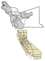
 Location of Emeryville in Alameda County, California. | |
| Coordinates: 37°49′53″N 122°17′07″W / 37.83139°N 122.28528°W | |
| Country | |
| State | |
| County | Alameda County |
| Incorporated | December 8, 1896[1] |
| • Mayor | John J. Bauters[2] |
| • State Senate | Nancy Skinner (D)[3] |
| • State Assembly | Tony Thurmond (D)[4] |
| • U. S. Congress | Barbara Lee (D)[5] |
| • ആകെ | 2.25 ച മൈ (5.84 ച.കി.മീ.) |
| • ഭൂമി | 1.28 ച മൈ (3.32 ച.കി.മീ.) |
| • ജലം | 0.97 ച മൈ (2.52 ച.കി.മീ.) 38.02% |
| ഉയരം | 23 അടി (7 മീ) |
| • ആകെ | 10,080 |
| • കണക്ക് (2016)[9] | 11,671 |
| • ജനസാന്ദ്രത | 9,110.85/ച മൈ (3,518.09/ച.കി.മീ.) |
| സമയമേഖല | UTC-8 (Pacific Standard Time Zone) |
| • Summer (DST) | UTC-7 (Pacific Daylight Time) |
| ZIP codes | 94608 |
| ഏരിയ കോഡ് | 510 |
| FIPS code | 06-22594 |
| GNIS feature IDs | 1658499, 2410436 |
| വെബ്സൈറ്റ് | www |
എമെരിവില്ലെ, അമേരിക്കൻ ഐക്യനാടുകളിലെ കാലിഫോർണിയയിൽ അലെമേഡ കൗണ്ടിയിൽ സ്ഥിതിചെയ്യുന്ന ഒരു ചെറിയ നഗരമാണ്. ബെർക്കിലിയ്ക്കും ഓക്ൿലാൻറിനുമിടയ്ക്കുള്ള ഒരു ഇടനാഴിയിൽ സ്ഥിതിചെയ്യുന്ന ഈ നഗരത്തിൻറെ പരിധി സാൻ ഫ്രാൻസിസ്കോ ഉൾക്കടൽ തീരം വരെ നീളുന്നു. സാൻ ഫ്രാൻസിസ്കോ, ബേ ബ്രിഡ്ജ്, കാലിഫോർണിയ യൂണിവേഴ്സിറ്റി, ബർക്കിലി, സിലിക്കൺ വാലി എന്നിവിടങ്ങളുമായുള്ള സാമീപ്യം ഈ നഗരത്തിൻറെ സമീപകാല സാമ്പത്തിക വളർച്ചയ്ക്ക് പ്രേരക ശക്തിയായിത്തീർന്നു.
അവലംബം[തിരുത്തുക]
- ↑ "California Cities by Incorporation Date". California Association of Local Agency Formation Commissions. Archived from the original (Word) on November 3, 2014. Retrieved March 27, 2013.
- ↑ "City of Emeryville, CA". Retrieved February 3, 2017.
- ↑ "Senators". State of California. Retrieved March 18, 2013.
- ↑ "Members Assembly". State of California. Retrieved March 18, 2013.
- ↑ "California's 13-ആം Congressional District - Representatives & District Map". Civic Impulse, LLC. Retrieved March 9, 2013.
- ↑ "2016 U.S. Gazetteer Files". United States Census Bureau. Retrieved Jul 19, 2017.
- ↑ "Emeryville". Geographic Names Information System. United States Geological Survey.
- ↑ "Table 4: Annual Estimates of the Resident Population for Incorporated Places in California, Listed Alphabetically: April 1, 2000 to July 1, 2008". United States Census Bureau, Population Division. 2009-07-01. Archived from the original (CSV) on 2010-03-27. Retrieved 2010-06-07.
- ↑ ഉദ്ധരിച്ചതിൽ പിഴവ്: അസാധുവായ
<ref>ടാഗ്;USCensusEst2016എന്ന പേരിലെ അവലംബങ്ങൾക്ക് എഴുത്തൊന്നും നൽകിയിട്ടില്ല.

