സലോങ്ക ദേശീയോദ്യാനം
| Salonga National Park | |
|---|---|
ഐ.യു.സി.എൻ. ഗണം II (ദേശീയോദ്യാനം) | |
 View of a river in the Salonga National Park in 2005 | |
| Location | Democratic Republic of the Congo |
| Coordinates | പ്രയോഗരീതിയിൽ പിഴവ്: തിരിച്ചറിയാൻ കഴിയാത്ത വിരാമചിഹ്നം ","km 2°S 21°E / 2°S 21°E |
| Area | 36,000 km2 (14,000 sq mi) |
| Established | 1970 |
| Governing body | l'Institut Congolais pour la Conservation de la Nature (ICCN) |
| Type | Natural |
| Criteria | vii, x |
| Designated | 1984 (8th session) |
| Reference no. | 280 |
| State Party | |
| Region | Africa |
| Endangered | 1999–present |
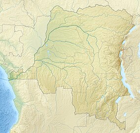
സലോങ്ക ദേശീയോദ്യാനം കോംഗോ നദി നദീതടത്തിൽ സ്ഥിതിചെയ്യുന്ന ഡെമോക്രാറ്റിക് റിപ്പബ്ലിക് ഓഫ് കോംഗോയിലെ ഒരു ദേശീയ ഉദ്യാനമാണ്. ആഫ്രിക്കയിലെ ഏറ്റവും വലിയ ഉഷ്ണമേഖലാ മഴക്കാടായ ഇത് ഏകദേശം 36,000 ചതുരശ്ര കിലോമീറ്റർ അഥവാ 3,600,000 ഹെക്ടർ (8,900,000 ഏക്കർ) വിസ്തീർണ്ണത്തിൽ പരന്നുകിടക്കുന്നു. മായ് ൻഡോംബെ, ഇക്വേറ്റിയർ, കസായി, സൻകുരു എന്നീ പ്രവിശ്യകളിലേക്ക് ഈ ദേശീയോദ്യാനം നീണ്ടു കിടക്കുന്നു.

