
പ്രമാണം:Australia South Australia location map.svg

പൂർണ്ണ വലിപ്പം (എസ്.വി.ജി. പ്രമാണം, നാമമാത്രമായ 1,535 × 1,783 പിക്സലുകൾ, പ്രമാണത്തിന്റെ വലിപ്പം: 367 കെ.ബി.)
| ഈ പ്രമാണം വിക്കിമീഡിയ കോമൺസിൽ നിന്നുള്ളതാണ്. പ്രമാണത്തെക്കുറിച്ചുള്ള വിവരണം താഴെ കൊടുത്തിരിക്കുന്നു.
|
ചുരുക്കം
| വിവരണം |
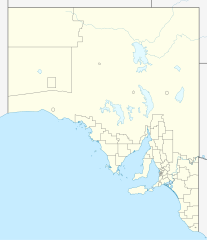
Quadratische Plattkarte, N-S-Streckung 117 %. Geographische Begrenzung der Karte:
Equirectangular projection, N/S stretching 117 %. Geographic limits of the map:
|
|
| തീയതി | ||
| സ്രോതസ്സ് |
സ്വന്തം സൃഷ്ടി, using
|
|
| സ്രഷ്ടാവ് | NordNordWest | |
| അനുമതി (ഈ പ്രമാണത്തിന്റെ പുനരുപയോഗം) |
ഈ പ്രമാണത്തിന് അനുമതി നൽകപ്പെട്ടിരിക്കുന്നത് ക്രിയേറ്റീവ് കോമൺസ് ആട്രിബ്യൂഷൻ-ഷെയർ എലൈക് 3.0 ജർമ്മനി അനുവാദപത്ര പ്രകാരമാണ്.
 ഈ പ്രമാണത്തിന് അനുമതി നൽകപ്പെട്ടിരിക്കുന്നത് ക്രിയേറ്റീവ് കോമൺസ് ആട്രിബ്യൂഷൻ-ഷെയർ എലൈക് 3.0 ജർമ്മനി അനുവാദപത്ര പ്രകാരമാണ്.
|


|
This map has been made or improved in the German Kartenwerkstatt (Map Lab). You can propose maps to improve as well.
|
പ്രമാണ നാൾവഴി
ഏതെങ്കിലും തീയതി/സമയ കണ്ണിയിൽ ഞെക്കിയാൽ പ്രസ്തുതസമയത്ത് ഈ പ്രമാണം എങ്ങനെയായിരുന്നു എന്നു കാണാം.
| തീയതി/സമയം | ലഘുചിത്രം | അളവുകൾ | ഉപയോക്താവ് | അഭിപ്രായം | |
|---|---|---|---|---|---|
| നിലവിലുള്ളത് | 22:08, 4 ഏപ്രിൽ 2010 | | 1,535 × 1,783 (367 കെ.ബി.) | Chumwa | Reverted to version as of 20:05, 29 December 2009 |
| 21:54, 4 ഏപ്രിൽ 2010 |  | 1,535 × 1,783 (316 കെ.ബി.) | Roke~commonswiki | local government low salience, dont appear on general use maps | |
| 20:05, 29 ഡിസംബർ 2009 |  | 1,535 × 1,783 (367 കെ.ബി.) | NordNordWest | =={{int:filedesc}}== {{Information |Description= {{de|Positionskarte von South Australia, Australien}} Quadratische Plattkarte, N-S-Streckung 117 %. Geographische Begrenzung der Karte: * N: 25.6° S * S: 38.5° S |
പ്രമാണത്തിന്റെ ഉപയോഗം
താഴെ കാണുന്ന 4 താളുകളിൽ ഈ ചിത്രം ഉപയോഗിക്കുന്നു:
പ്രമാണത്തിന്റെ ആഗോള ഉപയോഗം
താഴെ കൊടുത്തിരിക്കുന്ന മറ്റ് വിക്കികൾ ഈ പ്രമാണം ഉപയോഗിക്കുന്നു:
- af.wikipedia.org സംരംഭത്തിലെ ഉപയോഗം
- ar.wikipedia.org സംരംഭത്തിലെ ഉപയോഗം
- ast.wikipedia.org സംരംഭത്തിലെ ഉപയോഗം
- azb.wikipedia.org സംരംഭത്തിലെ ഉപയോഗം
- ba.wikipedia.org സംരംഭത്തിലെ ഉപയോഗം
- be.wikipedia.org സംരംഭത്തിലെ ഉപയോഗം
- bg.wikipedia.org സംരംഭത്തിലെ ഉപയോഗം
- ceb.wikipedia.org സംരംഭത്തിലെ ഉപയോഗം
- de.wikipedia.org സംരംഭത്തിലെ ഉപയോഗം
- Adelaide
- Coober Pedy
- Klemzig
- Woomera (Australien)
- Riverland
- Goodwood (South Australia)
- Keith (Australien)
- Hahndorf (South Australia)
- Waterfall Gully
- Maralinga
- Renmark
- Naracoorte
- William Creek
- Aldgate (South Australia)
- Mount Gambier
- Murray Bridge
- Port Augusta
- Port Pirie
- Port Lincoln
- Victor Harbor
- Whyalla
- Anna Creek Station
- Tarcoola
- Melrose (South Australia)
- Cook (South Australia)
- Vorlage:Positionskarte Australien Südaustralien
- Lobethal
- Ooldea
- Flughafen Port Augusta
- Flugplatz Coober Pedy
- Angaston
- Mungeranie
- Wikipedia:Kartenwerkstatt/Positionskarten/Australien und Ozeanien
- Burra (Australien)
ഈ പ്രമാണത്തിന്റെ കൂടുതൽ ആഗോള ഉപയോഗം കാണുക.