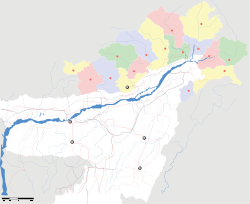
"ഉപയോക്താവ്:Rojypala/test" എന്ന താളിന്റെ പതിപ്പുകൾ തമ്മിലുള്ള വ്യത്യാസം
Content deleted Content added
No edit summary |
No edit summary |
||
| വരി 1: | വരി 1: | ||
{{Infobox Indian Jurisdiction | |
|||
{{Hatnote|<!-- |
|||
native_name= Pakke Tiger Reserve |<ref name=birand>Birand, A & Pawar, S (2004) An ornithological survey in north-east India. ''Forktail''20. p.15–24. [http://www.orientalbirdclub.org/publications/forktail/20pdfs/Birand-NEIndia.pdf PDF]</ref> |
|||
-->"{{{1}}}" ഇവിടേക്ക് തിരിച്ചുവിട്ടിരിക്കുന്നു. {{#if:{{{2|}}}|{{{2}}}|മറ്റുപയോഗങ്ങൾക്കായി}}, {{#if:{{{3|}}}|[[:{{{3}}}]]{{#ifeq:{{{4|}}}|and| and {{#if:{{{5|}}}|[[:{{{5}}}]]|[[{{{1}}} (വിവക്ഷകൾ)]]}}}}|[[{{{1}}} (വിവക്ഷകൾ)]]}}.കാണുക.<!-- |
|||
other_name = Pakhui Tiger Reserve | |
|||
-->{{#if:{{{2|}}}|{{#if:{{{4|}}}|<!-- |
|||
type= Tiger Reserve | |
|||
-->{{#ifeq:{{{4|}}}|and||<!-- "and" is a special word, don't output "For and, ..." |
|||
iucn_category = II | |
|||
-->  For {{#ifeq:{{{4}}}|1|other uses|{{{4}}}}}, see {{#if:{{{5|}}}|[[:{{{5}}}]]{{#ifeq:{{{6|}}}|and| and {{#if:{{{7|}}}|[[:{{{7}}}]]|[[{{{4}}} (disambiguation)]]}}}}|[[{{{4}}} (disambiguation)]]}}.}}<!-- |
|||
latd = 27|latm =05 | |
|||
-->{{#if:{{{6|}}}|<!-- |
|||
longd =92|longm=51.5| |
|||
-->{{#ifeq:{{{6|}}}|and||<!-- |
|||
locator_position=right| |
|||
-->  For {{#ifeq:{{{6}}}|1|other uses|{{{6}}}}}, see {{#if:{{{7|}}}|[[:{{{7}}}]]{{#ifeq:{{{8|}}}|and| and {{#if:{{{9|}}}|[[:{{{9}}}]]|[[{{{6}}} (disambiguation)]]}}}}|[[{{{6}}} (disambiguation)]]}}.}}<!-- |
|||
inset_map = yes | |
|||
-->{{#if:{{{8|}}}|<!-- |
|||
inset_map_size = 100px | |
|||
-->{{#ifeq:{{{8|}}}|and||<!-- |
|||
inset_map_x = 175px | |
|||
-->  For {{#ifeq:{{{8}}}|1|other uses|{{{8}}}}}, see {{#if:{{{9|}}}|[[:{{{9}}}]]|[[{{{8}}} (disambiguation)]]}}.}}<!-- |
|||
inset_map_y = 225px | |
|||
-->}}<!-- |
|||
inset_map_marker = yes | |
|||
-->}}<!-- |
|||
inset_map_marker_size = 4x4px | |
|||
-->}}}}}}{{#switch:{{{1<noinclude>|REDIRECT</noinclude>}}}|REDIRECT|REDIRECT1|REDIRECT2|REDIRECT3|TERM = | #default = {{#ifexist:{{{1}}}||[[Category:Missing redirects]]}}}}<noinclude> |
|||
inset_map_default = yes | |
|||
skyline = | |
|||
skyline_caption = | |
|||
state_name= Arunachal Pradesh | |
|||
district= [[East Kameng]]| |
|||
nearest_city = [[Rangapara]] {{convert|36.2|km}} NE | |
|||
blank_title_1 = Governing body | |
|||
blank_value_1 = [http://arunachalforests.gov.in/ '''Secretary (Environment & Forest), Government of Arunachal Pradesh''']| |
|||
altitude= 2040 | |
|||
area_total= 861.95 | |
|||
precip=2506 | |
|||
temp_summer= 36 | |
|||
temp_winter= 12 | |
|||
climate= Cwa| |
|||
established_title = Established | |
|||
established_date = 1966 | |
|||
website= http://projecttiger.nic.in/pakhui.htm | |
|||
website_caption=<big>'''Pakke Tiger Reserve'''</big>| |
|||
footnotes =<ref name=birand /><ref name="Tapi"/> | |
|||
}} |
|||
{{ |
{{RL}} |
||
</noinclude> |
|||
09:41, 2 ജൂലൈ 2013-നു നിലവിലുണ്ടായിരുന്ന രൂപം
| Pakke Tiger Reserve | |
ഐ.യു.സി.എൻ., വർഗ്ഗം II (ദേശീയോദ്യാനം)
| |
| രാജ്യം | |
| സംസ്ഥാനം | Arunachal Pradesh |
| ജില്ല(കൾ) | East Kameng |
| Established | 1966 |
| ഏറ്റവും അടുത്ത നഗരം | Rangapara 36.2 kilometres (22.5 mi) NE |
| സമയമേഖല | IST (UTC+5:30) |
| വിസ്തീർണ്ണം • സമുദ്രനിരപ്പിൽ നിന്നുള്ള ഉയരം |
861.95 km² (333 sq mi) • 2,040 m (6,693 ft) |
| കാലാവസ്ഥ • Precipitation താപനില • വേനൽ • ശൈത്യം |
Cwa (Köppen) • 2,506 mm (98.7 in) • 36 °C (97 °F) • 12 °C (54 °F) |
| Governing body | Secretary (Environment & Forest), Government of Arunachal Pradesh |
| വെബ്സൈറ്റ് | Pakke Tiger Reserve |
27°05′00″N 92°51.5′00″E / 27.08333°N 92.85833°E{{#coordinates:}}: അസാധുവായ രേഖാംശം


