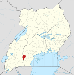
ല്യൻടോൻഡെ ജില്ല
ല്യൻടോൻഡെ ജില്ല | |
|---|---|
 District location in Uganda | |
| Coordinates: 00°25′S 31°10′E / 0.417°S 31.167°E | |
| Country | |
| Region | Central Uganda |
| Capital | ല്യൻടോൻഡെ |
| • ഭൂമി | 888.1 ച.കി.മീ.(342.9 ച മൈ) |
| ഉയരം | 1,260 മീ(4,130 അടി) |
(2012 ഏകദേശം) | |
| • ആകെ | 80,200 |
| • ജനസാന്ദ്രത | 90.3/ച.കി.മീ.(234/ച മൈ) |
| സമയമേഖല | UTC+3 ((EAT)) |
| വെബ്സൈറ്റ് | www |
ഉഗാണ്ടയുടെ മദ്ധ്യ മേഖലയിലെ ജില്ലയാണ് ല്യൻടോൻഡെ ജില്ല (Lyantonde District). ജില്ലയുടെ പ്രധാന പട്ടണം, ഉപ്മേഘര്യിലെ വലിയ പട്ടണമായ മസകയിൽ നിന്നും 78 കി.മീ. പടിഞ്ഞാറാണ്. ജില്ലയുടെ നിർദ്ദേശാങ്കങൾ: 00 25S, 31 10Eആണ്.
