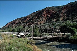
റോറിംഗ് ഫോർക്ക് റിവർ
| Roaring Fork River | |
|---|---|
 | |
 Map of the Roaring Fork River | |
| Country | United States |
| State | Colorado |
| Physical characteristics | |
| പ്രധാന സ്രോതസ്സ് | Independence Lake White River National Forest, Pitkin County 12,490 ft (3,810 m) 39°08′38″N 106°34′04″W / 39.14389°N 106.56778°W[1] |
| നദീമുഖം | Colorado River Glenwood Springs, Garfield County 5,718 ft (1,743 m) 39°32′57″N 107°19′47″W / 39.54917°N 107.32972°W[1] |
| നീളം | 70 mi (110 km) |
| Discharge | |
| നദീതട പ്രത്യേകതകൾ | |
| നദീതട വിസ്തൃതി | 1,453 sq mi (3,760 km2)[2] |
| പോഷകനദികൾ |
|
റോറിംഗ് ഫോർക്ക് നദി അമേരിക്കൻ ഐക്യനാടുകളിലെ പടിഞ്ഞാറൻ, മധ്യ കൊളറാഡോയിലൂടെ ഒഴുകുന്ന ഏകദേശം 70 മൈൽ (110 കിലോമീറ്റർ) നീളമുള്ള കൊളറാഡോ നദിയുടെ ഒരു കൈവഴിയാണ്. റിസോർട്ട് നഗരമായ ആസ്പനും ആസ്പൻ/സ്നോമാസ് റിസോർട്ടുകളും ഉൾപ്പെടുന്ന കൊളറാഡോ വെസ്റ്റേൺ സ്ലോപ്പ് മേഖലയിലെ റോറിംഗ് ഫോർക്ക് വാലി അഥവാ റോറിംഗ് ഫോർക്ക് നീർത്തടം എന്ന് വിളിക്കപ്പെടുന്ന ജനവാസമുള്ളതും സാമ്പത്തികമായി സുപ്രധാനവുമായ ഒരു പ്രദേശത്തുകൂടിയാണ് നദി ഒഴുകുന്നത്.
അവലംബം[തിരുത്തുക]
- ↑ 1.0 1.1 "Roaring Fork River". Geographic Names Information System. United States Geological Survey.
- ↑ 2.0 2.1 2.2 ഉദ്ധരിച്ചതിൽ പിഴവ്: അസാധുവായ
<ref>ടാഗ്;nwisഎന്ന പേരിലെ അവലംബങ്ങൾക്ക് എഴുത്തൊന്നും നൽകിയിട്ടില്ല.
