മൗണ്ട് എൽഗോൺ ദേശീയോദ്യാനം
| മൗണ്ട് എൽഗോൺ ദേശീയോദ്യാനം | |
|---|---|
ഐ.യു.സി.എൻ. ഗണം II (ദേശീയോദ്യാനം) | |
| Location | |
| Nearest city | Mbale |
| Coordinates | 01°08′00″N 34°35′00″E / 1.13333°N 34.58333°E |
| Area | 1,279 km2 (494 sq mi) (total) |
| Established | Kenya: 1968, Uganda: 1992 |
| Governing body | Kenya Wildlife Service, Uganda Wildlife Authority |
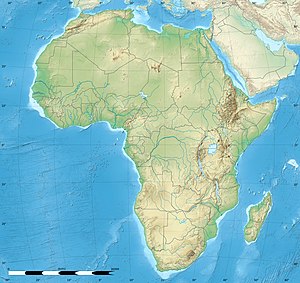
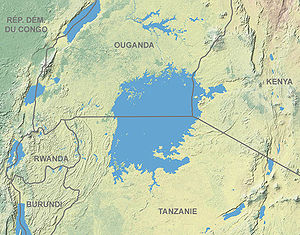
മൗണ്ട് എൽഗോൺ ദേശീയോദ്യാനം, വിക്ടോറിയ തടാകത്തിന് 140 കിലോമീറ്റർ (87 മൈൽ) വടക്കുകിഴക്കായി സ്ഥിതിചെയ്യുന്ന കെനിയയിലെ ഒരു ദേശീയോദ്യാനമാണ്. 1,279 ചതുരശ്ര കിലോമീറ്ററാണ് (494 ചതുരശ്ര മൈൽ) വിസ്തൃതിയിൽ വ്യാപിച്ചുകിടക്കുന്ന ഈ ദേശീയോദ്യാനം, കെനിയയുടെയും ഉഗാണ്ടയുടെയും അതിർത്തികളിലാണ് സ്ഥിതിചെയ്യുന്നത്. ഉഗാണ്ടൻ ഭാഗത്തുള്ള ദേശീയോദ്യാനത്തിന് 1,110 ചതുരശ്ര കിലോമീറ്റർ (430 ചതുരശ്ര മൈൽ വിസ്തൃതിയും, കെനിയൻ ഭാഗം 169 ചതുരശ്ര കിലോമീറ്റർ (65 ചതുരശ്ര മൈൽ) വിസ്തൃതിയുമുള്ളതാണ്.[1][2] കെനിയൻ ഭാഗം 1968 ലും[3] ഉഗാണ്ടൻ ഭാഗം 1992 ലും[4] ദേശീയോദ്യാനമായി വിജ്ഞാപനം നടത്തപ്പെട്ടു.
അവലംബം[തിരുത്തുക]
- ↑ "Uganda–Mount Elgon". World Database on Protected Areas. Retrieved 10 October 2008.[പ്രവർത്തിക്കാത്ത കണ്ണി]
- ↑ "Kenya–Mount Elgon". World Database on Protected Areas. Retrieved 10 October 2008.[പ്രവർത്തിക്കാത്ത കണ്ണി]
- ↑ "Mount Elgon National Park". Kenya Wildlife Service. Retrieved 30 December 2009.[പ്രവർത്തിക്കാത്ത കണ്ണി]
- ↑ "Uganda–Mount Elgon". World Database on Protected Areas. Retrieved 10 October 2008.[പ്രവർത്തിക്കാത്ത കണ്ണി]


