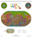
പ്രമാണം:USGS-MarsMap-sim3292-20140714-crop.png

ഈ പ്രിവ്യൂവിന്റെ വലിപ്പം: 532 × 599 പിക്സലുകൾ. മറ്റ് റെസലൂഷനുകൾ: 213 × 240 പിക്സലുകൾ | 426 × 480 പിക്സലുകൾ | 682 × 768 പിക്സലുകൾ | 909 × 1,024 പിക്സലുകൾ | 1,819 × 2,048 പിക്സലുകൾ | 3,773 × 4,249 പിക്സലുകൾ.
പൂർണ്ണ വലിപ്പം (3,773 × 4,249 പിക്സൽ, പ്രമാണത്തിന്റെ വലിപ്പം: 8.88 എം.ബി., മൈം തരം: image/png)
പ്രമാണ നാൾവഴി
ഏതെങ്കിലും തീയതി/സമയ കണ്ണിയിൽ ഞെക്കിയാൽ പ്രസ്തുതസമയത്ത് ഈ പ്രമാണം എങ്ങനെയായിരുന്നു എന്നു കാണാം.
| തീയതി/സമയം | ലഘുചിത്രം | അളവുകൾ | ഉപയോക്താവ് | അഭിപ്രായം | |
|---|---|---|---|---|---|
| നിലവിലുള്ളത് | 17:03, 6 നവംബർ 2014 |  | 3,773 × 4,249 (8.88 എം.ബി.) | Kopiersperre | optipng |
| 21:07, 23 ജൂലൈ 2014 |  | 3,773 × 4,249 (11.03 എം.ബി.) | Drbogdan | User created page with UploadWizard |
പ്രമാണത്തിന്റെ ഉപയോഗം
താഴെ കാണുന്ന 2 താളുകളിൽ ഈ ചിത്രം ഉപയോഗിക്കുന്നു:
പ്രമാണത്തിന്റെ ആഗോള ഉപയോഗം
താഴെ കൊടുത്തിരിക്കുന്ന മറ്റ് വിക്കികൾ ഈ പ്രമാണം ഉപയോഗിക്കുന്നു:
- ar.wikipedia.org സംരംഭത്തിലെ ഉപയോഗം
- az.wikipedia.org സംരംഭത്തിലെ ഉപയോഗം
- ca.wikipedia.org സംരംഭത്തിലെ ഉപയോഗം
- de.wikipedia.org സംരംഭത്തിലെ ഉപയോഗം
- en.wikipedia.org സംരംഭത്തിലെ ഉപയോഗം
- en.wikibooks.org സംരംഭത്തിലെ ഉപയോഗം
- es.wikipedia.org സംരംഭത്തിലെ ഉപയോഗം
- eu.wikipedia.org സംരംഭത്തിലെ ഉപയോഗം
- fa.wikipedia.org സംരംഭത്തിലെ ഉപയോഗം
- he.wikipedia.org സംരംഭത്തിലെ ഉപയോഗം
- it.wikipedia.org സംരംഭത്തിലെ ഉപയോഗം
- ja.wikipedia.org സംരംഭത്തിലെ ഉപയോഗം
- km.wikipedia.org സംരംഭത്തിലെ ഉപയോഗം
- mk.wikipedia.org സംരംഭത്തിലെ ഉപയോഗം
- mnw.wikipedia.org സംരംഭത്തിലെ ഉപയോഗം
- nl.wikipedia.org സംരംഭത്തിലെ ഉപയോഗം
- pl.wikipedia.org സംരംഭത്തിലെ ഉപയോഗം
- ro.wikipedia.org സംരംഭത്തിലെ ഉപയോഗം
- ru.wikipedia.org സംരംഭത്തിലെ ഉപയോഗം
- th.wikipedia.org സംരംഭത്തിലെ ഉപയോഗം
- tt.wikipedia.org സംരംഭത്തിലെ ഉപയോഗം
- uk.wikipedia.org സംരംഭത്തിലെ ഉപയോഗം
- zh.wikipedia.org സംരംഭത്തിലെ ഉപയോഗം


