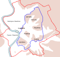
പ്രമാണം:Roma Plan.jpg

ഈ പ്രിവ്യൂവിന്റെ വലിപ്പം: 754 × 600 പിക്സലുകൾ. മറ്റ് റെസലൂഷനുകൾ: 302 × 240 പിക്സലുകൾ | 604 × 480 പിക്സലുകൾ | 966 × 768 പിക്സലുകൾ | 1,280 × 1,018 പിക്സലുകൾ | 1,840 × 1,463 പിക്സലുകൾ.
പൂർണ്ണ വലിപ്പം (1,840 × 1,463 പിക്സൽ, പ്രമാണത്തിന്റെ വലിപ്പം: 2.5 എം.ബി., മൈം തരം: image/jpeg)
പ്രമാണ നാൾവഴി
ഏതെങ്കിലും തീയതി/സമയ കണ്ണിയിൽ ഞെക്കിയാൽ പ്രസ്തുതസമയത്ത് ഈ പ്രമാണം എങ്ങനെയായിരുന്നു എന്നു കാണാം.
| തീയതി/സമയം | ലഘുചിത്രം | അളവുകൾ | ഉപയോക്താവ് | അഭിപ്രായം | |
|---|---|---|---|---|---|
| നിലവിലുള്ളത് | 16:14, 30 മാർച്ച് 2015 |  | 1,840 × 1,463 (2.5 എം.ബി.) | Jonstevn | Reverted to version as of 19:01, 28 August 2006 |
| 16:10, 30 മാർച്ച് 2015 |  | 1,840 × 1,463 (2.5 എം.ബി.) | Jonstevn | Reverted to version as of 19:01, 28 August 2006 | |
| 16:10, 30 മാർച്ച് 2015 |  | 1,840 × 1,463 (2.5 എം.ബി.) | Jonstevn | Reverted to version as of 19:01, 28 August 2006 | |
| 06:40, 27 ജൂലൈ 2008 |  | 1,840 × 1,463 (3.38 എം.ബി.) | Amadscientist | {{Information |Description= |Source= |Date= |Author= |Permission= |other_versions= }} | |
| 04:57, 27 ജൂലൈ 2008 |  | 4,000 × 3,180 (12.21 എം.ബി.) | Amadscientist | {{Information |Description= |Source= |Date= |Author= |Permission= |other_versions= }} | |
| 19:01, 28 ഓഗസ്റ്റ് 2006 |  | 1,840 × 1,463 (2.5 എം.ബി.) | Nikephoros | {{Information |Description=Plan Roms im Altertum / Map of Rome during Antiquity |Source=G. Droysens Allgemeiner Historischer Handatlas |Date=1886 |Author=? |Permission= not needed |other_versions= no }} |
പ്രമാണത്തിന്റെ ഉപയോഗം
താഴെ കാണുന്ന താളിൽ ഈ ചിത്രം ഉപയോഗിക്കുന്നു:
പ്രമാണത്തിന്റെ ആഗോള ഉപയോഗം
താഴെ കൊടുത്തിരിക്കുന്ന മറ്റ് വിക്കികൾ ഈ പ്രമാണം ഉപയോഗിക്കുന്നു:
- ar.wikipedia.org സംരംഭത്തിലെ ഉപയോഗം
- as.wikipedia.org സംരംഭത്തിലെ ഉപയോഗം
- azb.wikipedia.org സംരംഭത്തിലെ ഉപയോഗം
- beta.wikiversity.org സംരംഭത്തിലെ ഉപയോഗം
- bg.wikipedia.org സംരംഭത്തിലെ ഉപയോഗം
- bn.wikipedia.org സംരംഭത്തിലെ ഉപയോഗം
- bs.wikipedia.org സംരംഭത്തിലെ ഉപയോഗം
- bxr.wikipedia.org സംരംഭത്തിലെ ഉപയോഗം
- ca.wikipedia.org സംരംഭത്തിലെ ഉപയോഗം
- ceb.wikipedia.org സംരംഭത്തിലെ ഉപയോഗം
- cs.wikipedia.org സംരംഭത്തിലെ ഉപയോഗം
ഈ പ്രമാണത്തിന്റെ കൂടുതൽ ആഗോള ഉപയോഗം കാണുക.


