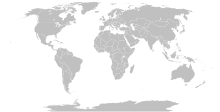
പ്രമാണം:Island nations.svg

ഈ SVG പ്രമാണത്തിന്റെ PNG പ്രിവ്യൂവിന്റെ വലിപ്പം: 800 × 411 പിക്സലുകൾ. മറ്റ് റെസലൂഷനുകൾ: 320 × 164 പിക്സലുകൾ | 640 × 329 പിക്സലുകൾ | 1,024 × 526 പിക്സലുകൾ | 1,280 × 657 പിക്സലുകൾ | 2,560 × 1,314 പിക്സലുകൾ | 863 × 443 പിക്സലുകൾ.
പൂർണ്ണ വലിപ്പം (എസ്.വി.ജി. പ്രമാണം, നാമമാത്രമായ 863 × 443 പിക്സലുകൾ, പ്രമാണത്തിന്റെ വലിപ്പം: 1.55 എം.ബി.)
പ്രമാണ നാൾവഴി
ഏതെങ്കിലും തീയതി/സമയ കണ്ണിയിൽ ഞെക്കിയാൽ പ്രസ്തുതസമയത്ത് ഈ പ്രമാണം എങ്ങനെയായിരുന്നു എന്നു കാണാം.
| തീയതി/സമയം | ലഘുചിത്രം | അളവുകൾ | ഉപയോക്താവ് | അഭിപ്രായം | |
|---|---|---|---|---|---|
| നിലവിലുള്ളത് | 11:15, 25 സെപ്റ്റംബർ 2023 |  | 863 × 443 (1.55 എം.ബി.) | Seabourn101 | Reverted to version as of 22:34, 31 May 2023 (UTC) |
| 18:55, 12 സെപ്റ്റംബർ 2023 |  | 863 × 443 (1.55 എം.ബി.) | Taekhosong | Reverted to version as of 09:33, 1 August 2018 (UTC) | |
| 22:34, 31 മേയ് 2023 |  | 863 × 443 (1.55 എം.ബി.) | Przemub | Reverted to version as of 16:20, 5 April 2023 (UTC). Another land border there is the one with Akrotiri and Dhekelia, which is internationally recognised. | |
| 08:27, 7 ഏപ്രിൽ 2023 |  | 863 × 443 (1.59 എം.ബി.) | Discombobulates | Cyprus shouldn't have a land border, the TRNC is recognised only by one country, its occupier | |
| 16:20, 5 ഏപ്രിൽ 2023 |  | 863 × 443 (1.55 എം.ബി.) | Jeffhardyfan08 | wrong file | |
| 16:20, 5 ഏപ്രിൽ 2023 |  | 1,000 × 514 (27 കെ.ബി.) | Jeffhardyfan08 | Added Greenland | |
| 06:38, 25 ഏപ്രിൽ 2022 |  | 863 × 443 (1.55 എം.ബി.) | Seabourn101 | Reverted to version as of 15:08, 1 September 2018 (UTC)- revert Unexplained reversion | |
| 04:26, 20 ഏപ്രിൽ 2022 |  | 863 × 443 (1.55 എം.ബി.) | Vodi.Dino.Eri | Reverted to version as of 20:31, 18 December 2015 (UTC) | |
| 15:08, 1 സെപ്റ്റംബർ 2018 |  | 863 × 443 (1.55 എം.ബി.) | 行到水穷处 | Reverted to version as of 16:05, 15 August 2018 (UTC) (as discussed) | |
| 14:05, 1 സെപ്റ്റംബർ 2018 |  | 863 × 443 (1.55 എം.ബി.) | 行到水穷处 | Reverted to version as of 09:33, 1 August 2018 (UTC) (No specific comment is provided for the last edit) |
പ്രമാണത്തിന്റെ ഉപയോഗം
താഴെ കാണുന്ന 2 താളുകളിൽ ഈ ചിത്രം ഉപയോഗിക്കുന്നു:
പ്രമാണത്തിന്റെ ആഗോള ഉപയോഗം
താഴെ കൊടുത്തിരിക്കുന്ന മറ്റ് വിക്കികൾ ഈ പ്രമാണം ഉപയോഗിക്കുന്നു:
- af.wikipedia.org സംരംഭത്തിലെ ഉപയോഗം
- ar.wikipedia.org സംരംഭത്തിലെ ഉപയോഗം
- az.wikipedia.org സംരംഭത്തിലെ ഉപയോഗം
- bn.wikipedia.org സംരംഭത്തിലെ ഉപയോഗം
- bs.wikipedia.org സംരംഭത്തിലെ ഉപയോഗം
- ca.wikipedia.org സംരംഭത്തിലെ ഉപയോഗം
- ckb.wikipedia.org സംരംഭത്തിലെ ഉപയോഗം
- da.wikipedia.org സംരംഭത്തിലെ ഉപയോഗം
- de.wikipedia.org സംരംഭത്തിലെ ഉപയോഗം
- en.wikipedia.org സംരംഭത്തിലെ ഉപയോഗം
- eo.wikipedia.org സംരംഭത്തിലെ ഉപയോഗം
- et.wikipedia.org സംരംഭത്തിലെ ഉപയോഗം
- eu.wikipedia.org സംരംഭത്തിലെ ഉപയോഗം
- fa.wikipedia.org സംരംഭത്തിലെ ഉപയോഗം
- fa.wikibooks.org സംരംഭത്തിലെ ഉപയോഗം
- fi.wikipedia.org സംരംഭത്തിലെ ഉപയോഗം
- fr.wikipedia.org സംരംഭത്തിലെ ഉപയോഗം
- fr.wiktionary.org സംരംഭത്തിലെ ഉപയോഗം
- gag.wikipedia.org സംരംഭത്തിലെ ഉപയോഗം
- gl.wikipedia.org സംരംഭത്തിലെ ഉപയോഗം
- he.wikipedia.org സംരംഭത്തിലെ ഉപയോഗം
- hi.wikipedia.org സംരംഭത്തിലെ ഉപയോഗം
- hu.wikipedia.org സംരംഭത്തിലെ ഉപയോഗം
- ia.wikipedia.org സംരംഭത്തിലെ ഉപയോഗം
- id.wikipedia.org സംരംഭത്തിലെ ഉപയോഗം
- ig.wikipedia.org സംരംഭത്തിലെ ഉപയോഗം
- ilo.wikipedia.org സംരംഭത്തിലെ ഉപയോഗം
- inh.wikipedia.org സംരംഭത്തിലെ ഉപയോഗം
- is.wiktionary.org സംരംഭത്തിലെ ഉപയോഗം
- it.wikipedia.org സംരംഭത്തിലെ ഉപയോഗം
- ja.wikipedia.org സംരംഭത്തിലെ ഉപയോഗം
- ko.wikipedia.org സംരംഭത്തിലെ ഉപയോഗം
- la.wikipedia.org സംരംഭത്തിലെ ഉപയോഗം
ഈ പ്രമാണത്തിന്റെ കൂടുതൽ ആഗോള ഉപയോഗം കാണുക.


