
പ്രമാണം:Assam locator map.svg

പൂർണ്ണ വലിപ്പം (എസ്.വി.ജി. പ്രമാണം, നാമമാത്രമായ 2,393 × 1,956 പിക്സലുകൾ, പ്രമാണത്തിന്റെ വലിപ്പം: 264 കെ.ബി.)
| ഈ പ്രമാണം വിക്കിമീഡിയ കോമൺസിൽ നിന്നുള്ളതാണ്. പ്രമാണത്തെക്കുറിച്ചുള്ള വിവരണം താഴെ കൊടുത്തിരിക്കുന്നു.
|
| തലക്കെട്ട് |
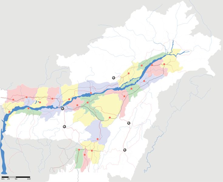
Assam locator Map |
||
| Description |
Map of w:Assam with road and rail lines. Coordinates: top=29.49, bottom=23.74, left=89.61, right=97.52. অসমীয়া: ৰেলপথ, যাত্ৰাপথ সমন্বিতে অসমৰ মানচিত্ৰ, স্থানাংক: ওপৰ=২৯.৪৯, তল=২৩.৭৪, বাও=৮৯.৬১, সো=৯৭.৫২। |
||
| തീയതി | |||
| സ്രോതസ്സ് |
സ്വന്തം സൃഷ്ടി |
||
| സ്രഷ്ടാവ് |
|
||
| അനുമതി (ഈ പ്രമാണത്തിന്റെ പുനരുപയോഗം) |
ഈ സൃഷ്ടിയുടെ പകർപ്പവകാശ ഉടമയായ ഞാൻ, താഴെ പറയുന്ന അനുമതിയിൽ ഈ സൃഷ്ടി ഇതിനാൽ പ്രസിദ്ധീകരിക്കുന്നു: ഈ പ്രമാണത്തിന് അനുമതി നൽകപ്പെട്ടിരിക്കുന്നത് ക്രിയേറ്റീവ് കോമൺസ് ആട്രിബ്യൂഷൻ-ഷെയർ എലൈക് 3.0 അൺപോർട്ടഡ് അനുവാദപത്ര പ്രകാരമാണ്.
|
||
| Geotemporal data | |||
| Date depicted | 20-ആം നൂറ്റാണ്ട് രണ്ടാം പകുതി ഒപ്പം 21-ആം നൂറ്റാണ്ട് | ||
| Georeferencing | If inappropriate please set warp_status = skip to hide. | ||
| Archival data | |||
| കുറിപ്പുകൾ | Part of WikiProject India Maps | ||
പ്രമാണ നാൾവഴി
ഏതെങ്കിലും തീയതി/സമയ കണ്ണിയിൽ ഞെക്കിയാൽ പ്രസ്തുതസമയത്ത് ഈ പ്രമാണം എങ്ങനെയായിരുന്നു എന്നു കാണാം.
| തീയതി/സമയം | ലഘുചിത്രം | അളവുകൾ | ഉപയോക്താവ് | അഭിപ്രായം | |
|---|---|---|---|---|---|
| നിലവിലുള്ളത് | 18:53, 16 ഏപ്രിൽ 2007 | | 2,393 × 1,956 (264 കെ.ബി.) | Planemad | |
| 18:36, 15 ഏപ്രിൽ 2007 |  | 2,393 × 1,956 (215 കെ.ബി.) | Planemad | ||
| 17:20, 13 ഏപ്രിൽ 2007 |  | 2,393 × 1,956 (206 കെ.ബി.) | Planemad | colored | |
| 16:56, 13 ഏപ്രിൽ 2007 |  | 2,393 × 1,956 (216 കെ.ബി.) | Planemad | crop fix | |
| 16:55, 13 ഏപ്രിൽ 2007 |  | 1,591 × 1,975 (216 കെ.ബി.) | Planemad | {{WikiProject_India_Maps |Title=Assam locator Map |Description=Map of w:Assam with road and rail lines |Source= [http://www.iitg.ernet.in/rcilts/assam_political.jpg IIT Guwahati - Assam Political map] |Date=April 2007 |Author=w:user:Planemad }} [ |
പ്രമാണത്തിന്റെ ഉപയോഗം
താഴെ കാണുന്ന 2 താളുകളിൽ ഈ ചിത്രം ഉപയോഗിക്കുന്നു:
പ്രമാണത്തിന്റെ ആഗോള ഉപയോഗം
താഴെ കൊടുത്തിരിക്കുന്ന മറ്റ് വിക്കികൾ ഈ പ്രമാണം ഉപയോഗിക്കുന്നു:
- ar.wikipedia.org സംരംഭത്തിലെ ഉപയോഗം
- as.wikipedia.org സംരംഭത്തിലെ ഉപയോഗം
- তেজপুৰ
- বৰপেটা
- যোৰহাট
- উত্তৰ লখিমপুৰ
- কামাখ্যা মন্দিৰ
- সদস্য:Anshuman.jrt/নলবাৰী
- সদস্য:Anshuman.jrt/শিলচৰ
- মাধৱ থান
- শিৱসাগৰৰ শিৱদৌল
- আউনীআটী সত্ৰ
- গহপুৰ
- শ্ৰী শ্ৰী বটদ্ৰৱা থান
- ঢেকীয়াখোৱা বৰনামঘৰ
- সাঁচ:Location map India Assam
- মহাভৈৰৱ মন্দিৰ
- সদস্য:Psneog/infobox mandir
- সদস্য:Vssun/test
- বিশ্বনাথ চাৰিআলি
- তিনিচুকীয়া
- নগাঁও
- বঙাইগাঁও
- ঢকুৱাখনা
- নাৰায়ণপুৰ
- ৰঙিয়া
- পাঠশালা
- নেঘেৰিটিং শিৱদৌল
- বদলা পদ্ম আতা সত্ৰ
- মাঘনোৱা দ’ল
- কাজিৰঙা ৰাষ্ট্ৰীয় উদ্যান
- বৰদৈবাম বিলমুখ পক্ষী উদ্যান
- বিহপুৰীয়া (নগৰ)
- কোকৰাঝাৰ
- কৰিমগঞ্জ
- হাৰিভাংগা
- সোণাৰি
- দ'দান থান
- কমাৰকুছি থান
- কৈহাটী
- মাণিকপুৰ
- পবিতৰা অভয়াৰণ্য
- মঙলদৈ
- মানস ৰাষ্ট্ৰীয় উদ্যান
- নামৰূপ
- জাতিংগা
- গুপ্তেশ্বৰ দেৱালয়
- শ্ৰী শ্ৰী আঠখেলীয়া নামঘৰ
- হোলোঙাপাৰ গিবন অভয়াৰণ্য
- গৰমপানী অভয়াৰণ্য
- তিতাবৰ মহকুমা
ഈ പ്രമാണത്തിന്റെ കൂടുതൽ ആഗോള ഉപയോഗം കാണുക.