"കൊളിമ നദി" എന്ന താളിന്റെ പതിപ്പുകൾ തമ്മിലുള്ള വ്യത്യാസം
(ചെ.) വർഗ്ഗം:ആർട്ടിക് കടലിൽ പതിക്കുന്ന നദികൾ ചേർത്തു ഹോട്ട്ക്യാറ്റ്... |
Rescuing 2 sources and tagging 0 as dead.) #IABot (v2.0.8 |
||
| വരി 44: | വരി 44: | ||
* William Barr, ''Baron Eduard von Toll’s Last Expedition: The Russian Polar Expedition, 1900-1903'' (1980). [http://pubs.aina.ucalgary.ca/arctic/Arctic34-3-201.pdf] |
* William Barr, ''Baron Eduard von Toll’s Last Expedition: The Russian Polar Expedition, 1900-1903'' (1980). [http://pubs.aina.ucalgary.ca/arctic/Arctic34-3-201.pdf] |
||
* Shalamov, Varlam Tikhonovich (1994) ''Kolyma tales'' [Kolymskie rasskazy], Glad, John (transl.), Penguin twentieth-century classics, Harmondsworth : Penguin, [[:en:Special:BookSources/0140186956|ISBN 0-14-018695-6]] |
* Shalamov, Varlam Tikhonovich (1994) ''Kolyma tales'' [Kolymskie rasskazy], Glad, John (transl.), Penguin twentieth-century classics, Harmondsworth : Penguin, [[:en:Special:BookSources/0140186956|ISBN 0-14-018695-6]] |
||
* Once-cursed Gulag river now Siberian lifeline: [http://dl1.yukoncollege.yk.ca/agraham/newsItems/departments/russia] |
* Once-cursed Gulag river now Siberian lifeline: [http://dl1.yukoncollege.yk.ca/agraham/newsItems/departments/russia] {{Webarchive|url=https://web.archive.org/web/20070818034943/http://dl1.yukoncollege.yk.ca/agraham/newsItems/departments/russia |date=2007-08-18 }} |
||
* [http://www.siberia.nu Strandberg, Mikael and Johan Ivarsson, travelled down the full length of the Kolyma River 2004. ][http://www.siberia.nu An Expedition hailed internationally as one of the coldest ever.] |
* [http://www.siberia.nu Strandberg, Mikael and Johan Ivarsson, travelled down the full length of the Kolyma River 2004. ][http://www.siberia.nu An Expedition hailed internationally as one of the coldest ever.] |
||
* [http://worldmaps.web.infoseek.co.jp/russia_guide.htm Position and names of islands] |
* [http://worldmaps.web.infoseek.co.jp/russia_guide.htm Position and names of islands] |
||
== അധിക ലിങ്കുകൾ == |
== അധിക ലിങ്കുകൾ == |
||
* ''[http://slovari.yandex.ru/~книги/БСЭ/Колыма Kolyma River]''<span> in the </span>''Great Soviet Encyclopedia''<span>, 1969–1978 (Russian)</span> |
* ''[http://slovari.yandex.ru/~книги/БСЭ/Колыма Kolyma River] {{Webarchive|url=https://web.archive.org/web/20111225024226/http://slovari.yandex.ru/~%D0%BA%D0%BD%D0%B8%D0%B3%D0%B8/%D0%91%D0%A1%D0%AD/%D0%9A%D0%BE%D0%BB%D1%8B%D0%BC%D0%B0 |date=2011-12-25 }}''<span> in the </span>''Great Soviet Encyclopedia''<span>, 1969–1978 (Russian)</span> |
||
* [http://earthtrends.wri.org/maps_spatial/maps_detail_static.cfm?map_select=358&theme=2 Information and a map of the Kolyma's watershed] |
* [http://earthtrends.wri.org/maps_spatial/maps_detail_static.cfm?map_select=358&theme=2 Information and a map of the Kolyma's watershed] |
||
* [http://www.panoramio.com/photo/6975262 Picture of Mikhalkino Island] |
* [http://www.panoramio.com/photo/6975262 Picture of Mikhalkino Island] |
||
17:56, 12 ഓഗസ്റ്റ് 2021-നു നിലവിലുണ്ടായിരുന്ന രൂപം
| കൊളിമ നദി | |
|---|---|
 | |
| Physical characteristics | |
| നദീമുഖം | ഈസ്റ്റ് സൈബീരിയൻ കടൽ |
| നീളം | 2,129 km (1,323 mi) |

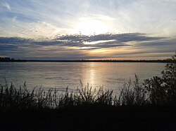
റഷ്യയിലെ , മഗദൻ ഒബ്ലാസ്റ്റ്, ചുക്കോത്ത്ക്ക അന്റോണമസ്, സക്കാ റിപ്പബ്ലിക്ക് ,എന്നീ സ്ഥലങ്ങളെ ആവരണം ചെയ്ത് കടന്നുപോകുന്ന ഒരു വടക്കു കിഴക്കൻ സൈബീരിയൻ നദിയാണ് കൊളിമ നദി (Russian: Колыма́; IPA: [kəlɨˈma]).കുലു നദിയുടേയും, അയൻ യുര്യാക്ക് നദിയുടേയും, സംഗമസ്ഥലത്ത് വച്ച് ഉത്ഭവിക്കുന്ന കൊളിമ,ആർട്ടിക് സമുദ്രത്തിന്റെ ഒരു ഭാഗമായ, കൊളിമഗൾഫിന്റെ കിഴക്ക് സൈബീരിയൻ കടലിൽ വച്ച് ഇല്ലാതാകുന്നു (കൊളിംസ്ക്കി സലീവ്)69°30′N 161°30′E.കൊളിമയ്ക്ക് 2,129 കിലോമീറ്റർ (1,323 മീ) നീളമുണ്ട്.ഇതിന്റെ തുറമുഖത്തിന് 644,000 സ്ക്വെയർ കിലോമീറ്ററുമാണ് വലിപ്പം(249,000 സ്വെയർ.മീ)
ഓരോ വർഷവും പെയ്തുകൊണ്ടിരിക്കുന്ന മഞ്ഞ് കൊളിമ നദിയെ വർഷത്തിൽ, 250 ദിവസത്തിന് തണുത്തുറഞ്ഞതാക്കുന്നു,പിന്നീട് ആ ഐസിൽ നിന്ന് മോചനം ലഭിക്കുക ജൂണിന് മുമ്പും, ഒക്ടോബറിന്റെ അവസാനവും മാത്രമാണ്.
കുടിയേറ്റം
കൊളിമ നദിയുടെ തീരത്തേക്കുള്ള കുടിയേറ്റങ്ങളിൽ സിനെഗോറി ഡെബിൻ, ഉസ്റ്റ്-സ്രെദ്നെകം, സെയ്മച്ചാൻ, സിറിയങ്ക, സ്രെഡ്നോകോളിംസ് എന്നീ വിഭാഗത്തിൽപെടുന്ന ജനങ്ങളും ഉൾപ്പെടുന്നു.
പ്രവേശന ദ്വാരങ്ങൾ
അവസാനത്തെ 75 കിലോമീറ്ററിൽ, ഒന്ന് വളഞ്ഞ്, കൊളിമ രണ്ട് വലിയ ശാഖകളായി പിരിയുന്നു.കിഴക്ക് സൈബീരിയൻ കടലെത്തുന്നതിന് മുമ്പുള്ള കൊളിമ നദിയുടെ വായ്ഭാഗത്ത് ധാരാളം ദ്വീപുകളുണ്ട്, അതിൽ പ്രധാനപ്പെട്ടവ താഴെ കൊടുക്കുന്നു.
- മിക്കൽക്കിനോ 69.416°N 161.255°E ആണ് ഏറ്റവും വലിയ ദ്വീപ്,കൊളിമയുടെ കിഴക്കൻ ശാഖയുടെ പടിഞ്ഞാറ് ഭാഗമായ, പുരാതനമായ കമ്മെന്നായ കോളിമയിലാണ് സ്ഥിതിചെയ്യുന്നത്.ഈ ദ്വീപ് വടക്കുഭാഗത്തെത്തുമ്പോഴേക്കും, ചെറിയ ചെറിയ കഷ്ണങ്ങളായി മാറുന്നു.ഇത് 24 കിലോമീറ്റർ (15 മീ) നീളവും, 6 കിലോമീറ്റർ(4 മീ) വീതിയുമുണ്ട്.മിക്കൽക്കിനോ "ഗ്ലാവ്സെവ്മോർപ്പുട്ട് ഐലാന്റ്" എന്നും അറിയപ്പെടുന്നു.
- മിക്കൽക്കിനോയുടെ വടക്ക്കിഴക്കുള്ള തീരപ്രദേശങ്ങളിൽ നിന്ന് 3 കിലോമീറ്റർ അകലേയാണ് സുക്കാർണി, അല്ലെങ്കിൽ സുക്കോർണി.ഇതിന് 11 കിലോമീറ്റർ (7 മീ) നീളവും, 5 കിലോമീറ്റർ (3 മീ) വീതിയുമുണ്ട്.വടക്ക്കിഴക്കുള്ള സുക്കോർണി, മോർസ്ക്കി സോട്ട്ക്കി എന്നറിയപ്പെടുന്ന ഒരു കൂട്ടം കുഞ്ഞു ദ്വീപുകളാണ്.
- പ്യാറ്റ്' പാൽ'ട്ട്സെവ്, സുക്കോർണിയുടെ തെക്കുഭാഗത്തുള്ള അന്ത്യത്തിൽ നിന്ന് 5 കിലോമീറ്റർ അകലെയാണ്.ഇത് 5 കിലോമീറ്റർ തന്നെ നീളവും, പരമാവധി 1.8 കിലോമീറ്റർ വീതിയുമുണ്ട്.
- നാസ്രോവ്സ്ക്കി 69.666°N 161.031°E
- ഷോട്ടോർമോവോയ് 69.666°N 161.031°E
ഗാലറി
 |
 |

അവലംബം
<ref> റ്റാഗ് <references> എന്നതിൽ നിർവചിച്ചിട്ടുണ്ടെങ്കിലും നാമ ഘടകം നൽകിയിട്ടില്ല.പ്രാഥമിക അറിവുകൾ
- William Barr, Baron Eduard von Toll’s Last Expedition: The Russian Polar Expedition, 1900-1903 (1980). [1]
- Shalamov, Varlam Tikhonovich (1994) Kolyma tales [Kolymskie rasskazy], Glad, John (transl.), Penguin twentieth-century classics, Harmondsworth : Penguin, ISBN 0-14-018695-6
- Once-cursed Gulag river now Siberian lifeline: [2] Archived 2007-08-18 at the Wayback Machine.
- Strandberg, Mikael and Johan Ivarsson, travelled down the full length of the Kolyma River 2004. An Expedition hailed internationally as one of the coldest ever.
- Position and names of islands
അധിക ലിങ്കുകൾ
- Kolyma River Archived 2011-12-25 at the Wayback Machine. in the Great Soviet Encyclopedia, 1969–1978 (Russian)
- Information and a map of the Kolyma's watershed
- Picture of Mikhalkino Island
