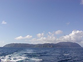
കൊക്കോസ് ഐലൻറ്
| Cocos Island National Park | |
|---|---|
ഐ.യു.സി.എൻ. ഗണം II (ദേശീയോദ്യാനം) | |
 Cocos Island | |
| Location | Approximately 550 km (340 mi) off the shore of Costa Rica |
| Coordinates | 5°31′08″N 87°04′18″W / 5.518889°N 87.071667°W |
| Established | 1978 |
| Type | Natural |
| Criteria | ix, x |
| Designated | 1997 (21st session) |
| Reference no. | 820 |
| Extension | 2002 |
| State Party | Costa Rica |
| Region | Central America |
| Designated | April 21, 1998 [1] |
കൊക്കോസ് ഐലൻറ് (സ്പാനിഷ്: Isla del Coco), കോസ്റ്റാറിക്കയിലെ തീരപ്രദേശത്തു നിന്ന് അകലെ ദേശീയോദ്യാനമായി അറിയപ്പെടുന്ന ഒരു ദ്വീപാണ്. കോസ്റ്റാറിക്കൻ പാർക്ക് റേഞ്ചേഴ്സ് ഒഴികെ മറ്റു നിവാസികൾക്ക് ഈ ദേശീയോദ്യാനത്തിലേയ്ക്ക് പ്രവേശനം അനുവദിക്കുന്നില്ല. ഇതു സ്ഥിതിചെയ്യുന്നത് പസഫിക് മഹാസമുദ്രത്തിൽ, കോസ്റ്റാറിക്കൻ പസഫിക് തീരത്തുനിന്ന് ഏകദേശം 550 കിലോമീറ്റർ (342 മൈൽ അഥവാ 297 നോട്ടിക്കൽ മൈൽ) അകലെയാണ്.
അവലംബം[തിരുത്തുക]
- ↑ "Ramsar List". Ramsar.org. Archived from the original on 9 April 2013. Retrieved 13 April 2013.

