കാലിമാനി ദേശീയോദ്യാനം
| കാലിമാനി ദേശീയോദ്യാനം | |
|---|---|
| Parcul Național Călimani | |
ഐ.യു.സി.എൻ. ഗണം II (ദേശീയോദ്യാനം) | |
 Călimani Mountains | |
Location within Romania | |
| Location | In the administrative territory of counties: |
| Nearest city | Vatra Dornei |
| Coordinates | 47°07′37″N 25°10′05″E / 47.127°N 25.168°E[1] |
| Area | 24.041 hectares (59.41 acres) |
| Established | 2000 |
| Website | www.calimani.ro |
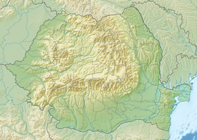
കാലിമാനി ദേശീയോദ്യാനം (റൊമാനിയൻ: Parcul Naţional Călimani) റൊമാനിയയിലെ ഒരു സംരക്ഷിത പ്രദേശമാണ് (ദേശീയോദ്യാനം വിഭാഗം II IUCN) റൊമാനിയയിലെ ഭരണപ്രദേശങ്ങളായ മുറേസ് (45%), സുസീവ (35%), ഹർഗിത (15%), ബിസ്ടിത-നസൌദ് എന്നീ കൌണ്ടികളുടെ ഭാഗങ്ങളിലാണ് ഈ ദേശീയോദ്യാനം നിലനിൽക്കുന്നത്.[2] കാലിമാനി മലനിരകൾ ഈ ദേശീയോദ്യാനത്തിൻറെ സംരക്ഷണ പരിധിയിൽ വരുന്നു.
അവലംബം[തിരുത്തുക]
- ↑ eunis.eea.europa.eu - Călimani National Park (coords.); retrieved on June 23, 2012
- ↑ protectedplanet.net - Călimani National Park (location) Archived 2014-10-20 at the Wayback Machine.; retrieved on June 23, 2012

