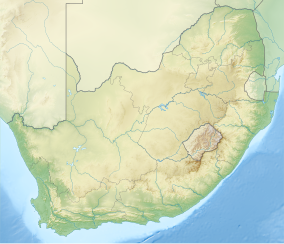
ഔഗ്രാബീസ് ഫാൾസ് ദേശീയോദ്യാനം
| Augrabies Falls National Park | |
|---|---|
ഐ.യു.സി.എൻ. ഗണം II (ദേശീയോദ്യാനം) | |
 The Augrabies Falls | |
| Location | Northern Cape, South Africa |
| Nearest city | Upington |
| Coordinates | 28°35′28″S 20°20′18″E / 28.59111°S 20.33833°E |
| Area | 820 km2 (320 sq mi) |
| Established | 1966 |
| Governing body | South African National Parks |
| www | |
ഔഗ്രാബീസ് ഫാൾസ് ദേശീയോദ്യാനം, ഔഗ്രാബീസ് വെള്ളച്ചാട്ടത്തിനു ചുറ്റുപാടുമായി, വടക്കൻ കേപ് മേഖലയിലെ ഉപിംഗ്ടൺ നഗരത്തിന് [1] 120 കിലോമീറ്റർ പടിഞ്ഞാറായി സ്ഥിതിചെയ്യുന്ന ദക്ഷിണാഫ്രിക്കയിലെ ഒരു ദേശീയോദ്യാനമാണ്. 1966 ലാണ് ഈ ദേശീയോദ്യാനം സ്ഥാപിക്കപ്പെട്ടത്.[2]
ഈ ദേശീയോദ്യാനം ഓറഞ്ച് നദിയ്ക്കു സമാന്തരമായി 820 ചതുരശ്രകിലോമീറ്റർ[3] പ്രദേശത്തു വ്യാപിച്ചു കിടക്കുന്നു. ഈ പ്രദേശം വളരെ വരണ്ടതാണ്. 60 മീറ്റർ ഉയരമുള്ള[4] ഔഗ്രാബീസ് വെള്ളച്ചാട്ടം നദിയിൽ വെള്ളപ്പൊക്കമുണ്ടാകുമ്പോൾ അതിശയകരമായി കാഴ്ചാനുഭവം പ്രദാനം ചെയ്യുന്നു. വെള്ളച്ചാട്ടത്തിനു താഴെയുള്ള മലയിടുക്ക് ഏകദേശം 240 മീറ്റർ ആഴമുള്ളതും 18 കിലോമീറ്ററോളം നീളത്തിലുമുള്ളതാണ്.
അവലംബം[തിരുത്തുക]
- ↑ Tony Pinchuck; Barbara McCrea; Donald Reid (2002). South Africa. Rough Guides. p. 323. ISBN 978-1-85828-853-6.
- ↑ Heather Du Plessis (1 January 2000). Tourism Destinations Southern Africa. Juta and Company Ltd. ISBN 978-0-7021-5272-6.
- ↑ "Augrabies Falls National Park (South African media online)". http://sanparks.africamediaonline.com/. Archived from the original on 2016-03-04. Retrieved 30 July 2015.
{{cite web}}: External link in|website= - ↑ "Augrabies Falls National Park". SA Places. Retrieved 30 July 2015.

